
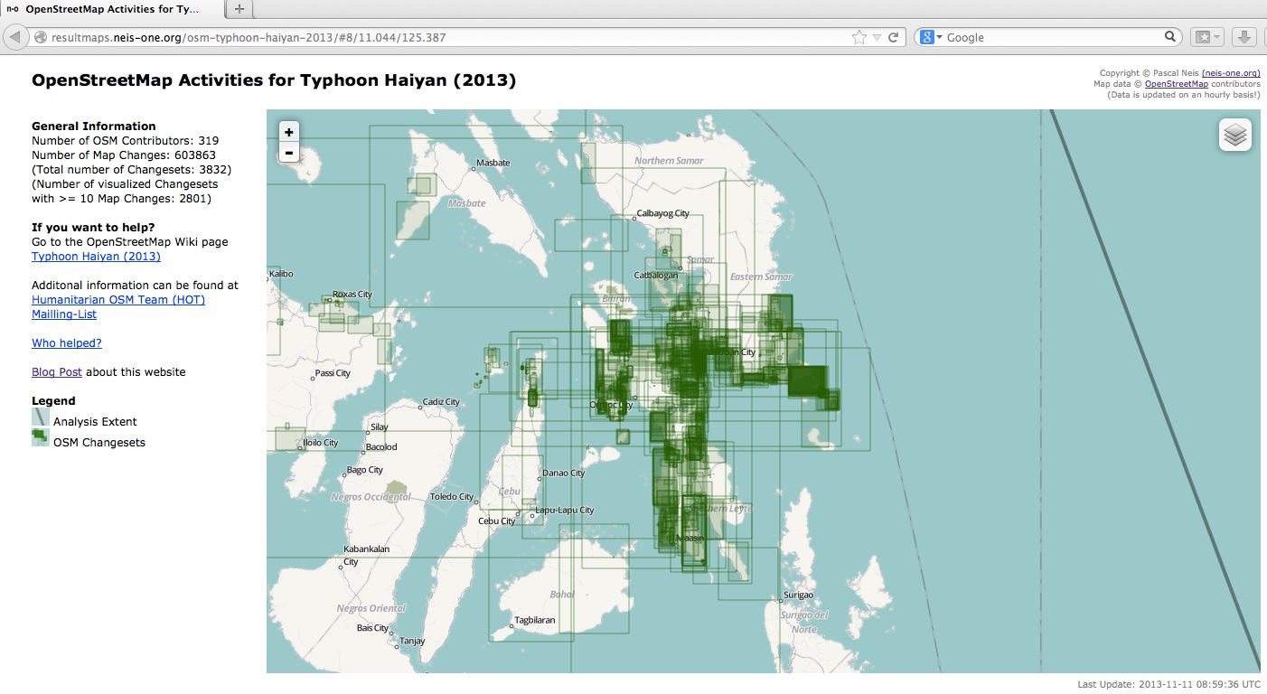
An new interactive visualization by our colleague Pascal Neis shows the latest changes to the OpenStreetMap database in the Philippines. This can help to identify areas where the OSM crisis mapper community is already activen and those where further contibutions are needed. Only OSM changesets in the Philippines and some parts of the Vietnam coast are used. The site is automatically updated on an hourly basis.
Thank you Pascal!
If you are an OpenStreetMap mapper – is still helpful that volunteers support by adding baseline data to OSM until further information (e.g. more recent satellite images) become available. Here you find some mapping jobs coordinated by the Humanitarian OpenStreetMap Team (H.O.T) using the H.O.T Tasking manager.
OSM Response to Typhoon Haiyan
by
Tags: