• Home
  • About

GIScience News Blog

News of Heidelberg University’s GIScience Research Group.

Feed on
Posts
Comments
« Natural Disasters 2.0: Video about VGI in Disaster Management at Reiss-Engelhorn Museum in Mannheim
Visitors from the ITC »

Field experiment: deriving pedestrian sidewalk information using LIDAR technology

Sep 15th, 2014 by Amin Mobasheri

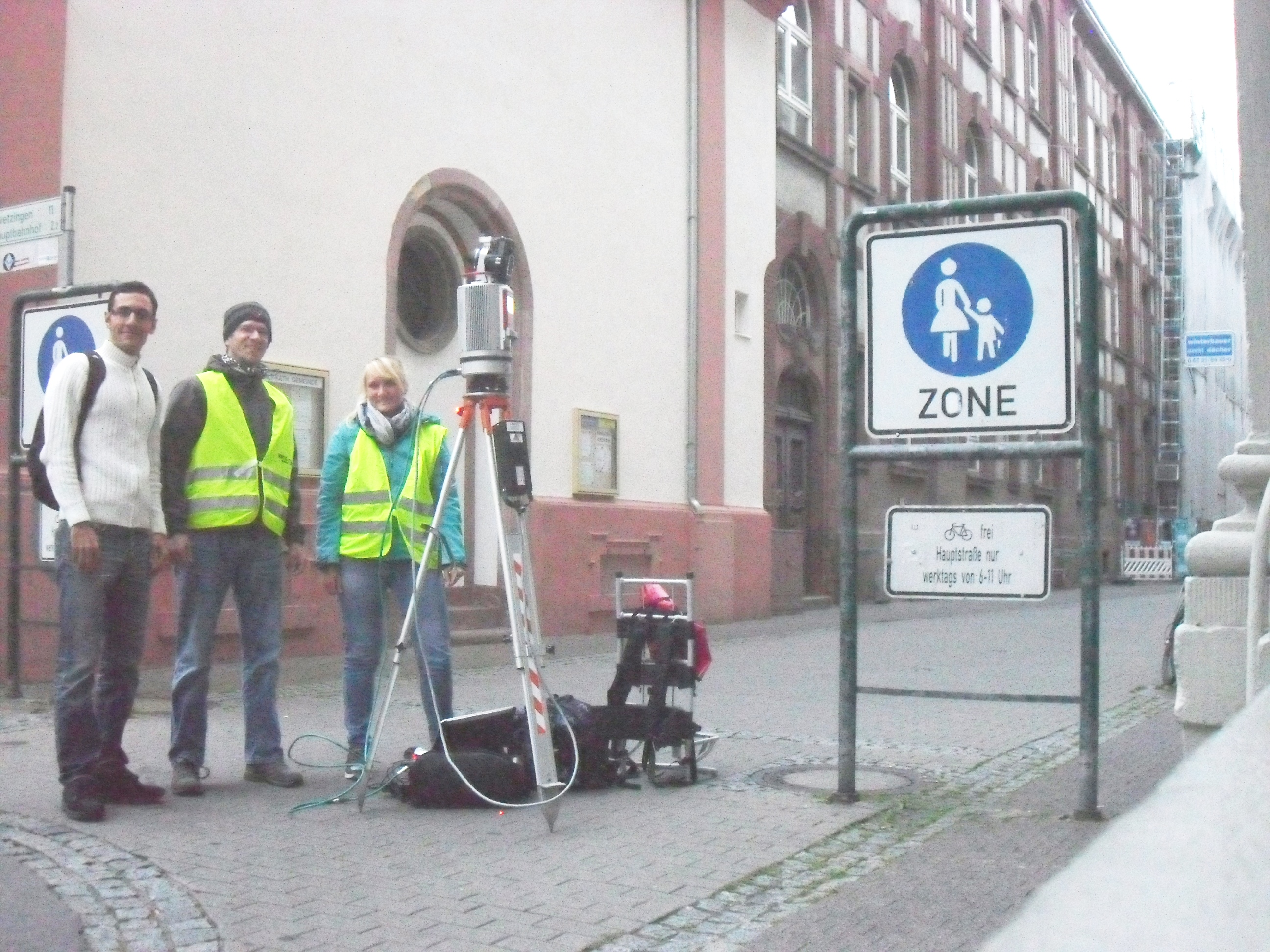
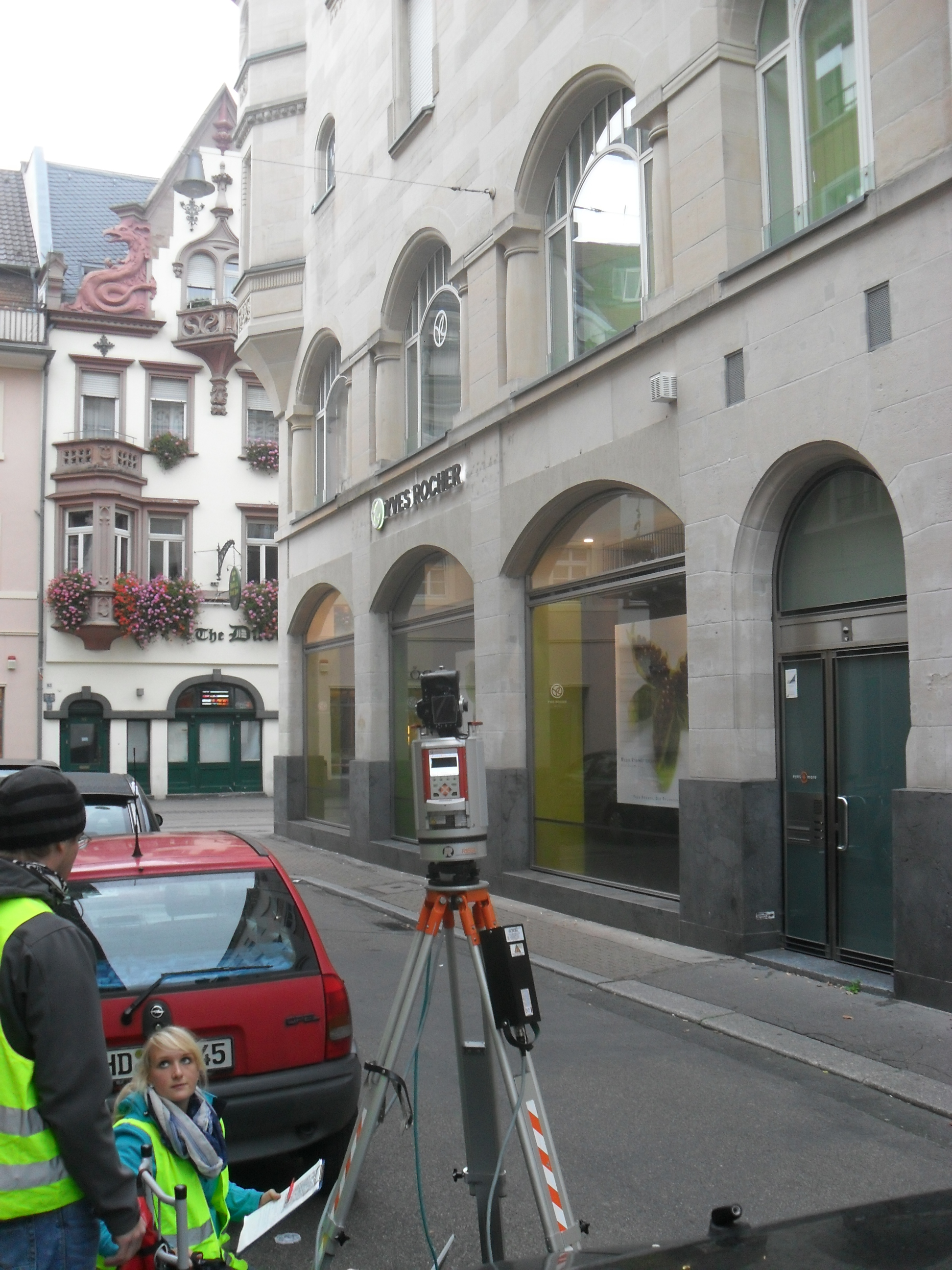
On 11th of September, the second experiment for the CAP4Access project for Heidelberg pilot city was performed by Smart Simulation group (led by Mohamed Bakillah) with collaboration of LIDAR research group of Heidelberg University. Bernhard Höfle, Amin Mobasheri and Evelyn Schmitz participated in this fieldwork, using RIEGL VZ-400 laser scanning device in order to collect 3D point clouds in the Heidelberg Altstadt area.

The places for data collection were selected based on the data and attribute requirements such as sidewalk geometries, vertical and horizontal slope, and height of sidewalks as well as surface texture type. The results of this experiment would be later used as a reference data with high accuracy for evaluating the quality of sidewalk information derived from GPS traces (for more information read the first experiment).

The experiment started at 06:00 a.m. and lasted for 5 hours. Almost 1 billion single highly precise 3D measurements were collected. Some minutes of raining caused difficulties, but the participants were quite happy with the efficiency of their work to cover the planned area plus some additional places, and enjoyed having fun with drinking warm coffee in the beautiful old-town of Heidelberg.

Group photo of fieldwork experiment participants

Group photo of fieldwork experiment participants

Setting up the device and getting prepared for data collection

Setting up the device and getting prepared for data collection

Collecting data in a horizontally and vertically sloped street with narrow-wide sidewalks and stoned surface texture

Collecting data in a horizontally and vertically sloped street with narrow-wide sidewalks and stoned surface texture

Tags: CAP4Access, Lidar, MyAccessible, Wheelchair Navigation

Posted in 3D, Events, Lidar Group, Research

Comments are closed.

  • About

    GIScience News Blog
    News of Heidelberg University’s GIScience Research Group.
    There are 934 Posts and 11 Comments so far.

  • Meta

    • Log in
    • Entries RSS
    • Comments RSS
    • WordPress.org
  • Recent Posts

    • R package for Openrouteservice released!
    • Upcoming Ohsome Conferences
    • Colloquium on Micro Diagrams for Geovisual Analysis of Point Datasets
    • Heidelberg Geography in Blossom
    • International PhD Defenses in 3DGeo Research
  • Tags

    3D Big Spatial Data CAP4Access Citizen Science Colloquium crisis mapping Crowd Analyser Crowdsourcing data quality disaster DisasterMapping GeoNet.MRN GIScience heigit Humanitarian OpenStreetMap team landuse laser scanning Lidar Mapathon MapSwipe MissingMaps Missing Maps navigation NEOHAZ Open data OpenMapSurfer OpenRouteService OpenStreetMap OSM Point Cloud Quality quality analysis remote sensing routing social media spatial analysis Twitter VGI web cartography WebGIS WebGL wheelchair Wheelchair Navigation WheelMap Workshop
  • Archives

    • April 2018
    • March 2018
    • February 2018
    • January 2018
    • December 2017
    • November 2017
    • October 2017
    • September 2017
    • August 2017
    • July 2017
    • June 2017
    • May 2017
    • April 2017
    • March 2017
    • February 2017
    • January 2017
    • December 2016
    • November 2016
    • October 2016
    • September 2016
    • August 2016
    • July 2016
    • June 2016
    • May 2016
    • April 2016
    • March 2016
    • February 2016
    • January 2016
    • December 2015
    • November 2015
    • October 2015
    • September 2015
    • August 2015
    • July 2015
    • June 2015
    • May 2015
    • April 2015
    • March 2015
    • February 2015
    • January 2015
    • December 2014
    • November 2014
    • October 2014
    • September 2014
    • August 2014
    • July 2014
    • June 2014
    • May 2014
    • April 2014
    • March 2014
    • February 2014
    • January 2014
    • December 2013
    • November 2013
    • October 2013
    • September 2013
    • August 2013
    • July 2013
    • June 2013
    • May 2013
    • April 2013
  •  

    September 2014
    M T W T F S S
    « Aug   Oct »
    1234567
    891011121314
    15161718192021
    22232425262728
    2930  
  • Recent Comments

    • Hier on Long-expected major Update on OpenRouteService with many new features in backend and frontend
    • Laser Entfernungsmesser on OpenStreetMap and Mapsurfer.NET help to search for missing people
    • Johnd371 on New OpenRouteService now with live traffic data, improved route profiles, new Leaflet client and more!
    • 4rx on New OpenRouteService now with live traffic data, improved route profiles, new Leaflet client and more!
    • nedir on Long-expected major Update on OpenRouteService with many new features in backend and frontend

GIScience News Blog CC by-nc-sa Some Rights Reserved.

Free WordPress Themes | Fresh WordPress Themes