
Flood emergency planning is a challenging task for many municipalities throughout the world, and particularly in Europe. Not only because there is no common methodology on how to detect the critical infrastructure that must be taking into account in emergency plans, but as well because of the fact that the changing flood-risk situation requires constant review and updating of spatial data.
These needs and problems are approached by the OpenFloodRiskMap project (“A decision support system based on user-generated spatial data for communities in support of emergency response planning in flood management”) that was launched by the GIScience team under the lead of Prof. Dr. João Porto de Albuquerque in cooperation with the company Leiner & Wolff GmbH Heidelberg and the City of Karlsruhe. The project is funded in the scope of the “Klimopass” research project by the Environmental Ministry of the State of Baden-Würtemberg through the Landesanstalt für Umwelt, Messungen und Naturschutz Baden-Württemberg (LUBW).

The objective of the project is the creation of a decision support system based on user-generated spatial data that will allow users to easily identify critical elements and infrastructure in their local environment. Therefore, a process model as well as a technical implementation will be developed in which official flood hazard maps and free geodata from OpenStreetMap will be combined. Thus, the advantages of official and open crowd-sourced data are combined and utilized to create a user-friendly application that will support the municipalities in the emergency response planning in flood management.
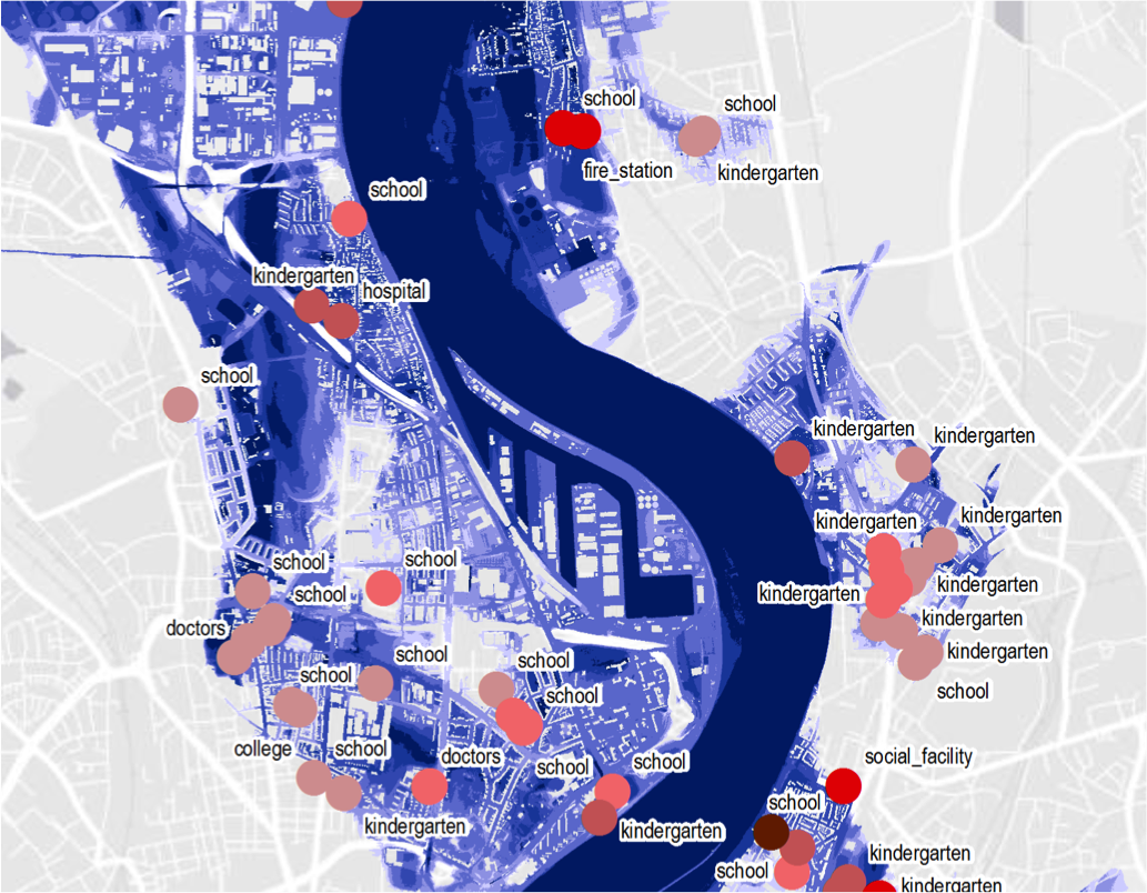
The usability and functionality of the decision support system for assisting municipalities in the development of alarming and emergency plans will be evaluated in the city of Karlsruhe.