• Home
  • About

GIScience News Blog

News of Heidelberg University’s GIScience Research Group.

Feed on
Posts
Comments
« Call for Applications: Research Group GIScience (Kleine Forschergruppe Geoinformatik) and Field Trip (Geländepraktikum / Übung) to Greece
Visual Crowds for Geo- and Environmental Sciences Conference Heidelberg »

Heidelberg Crisis Mappers Colloquium next Wednesday

Nov 21st, 2014 by GIScienceHD

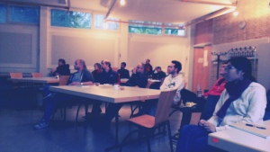
Here you find a report on the last Mapping Party at Heidelberg University organized by the Heidelberg Crisis Mappers with Kate Chapman, the Executive Director of the Humanitarian OpenStreetMap Team (HOT) giving a lecture and then there is an invitation to join the upcoming

Crisis Mapping Colloquium

on Wednesday (26 Nov 2014, 16-18 clock,

Dep. of Geography, Heidelberg, Berliner Strasse 48, Big PC pool).

This time you get the chance at a workshop 10000000000000 know the different ways you can use OpenStreetMap. This is the ideal opportunity to deepen your knowledge of GIS or to venture an introduction to GIS in a casual atmosphere.

There is something for everyone:

In a beginner-workshop one learns the basics in using OSM with GIS .

In an intermediate-workshop you can learn how to extract OSM data in various ways, how to process and integrate it with other spatial data and how typical pitfalls can be avoided.

In a profi-workshop we look forward to welcoming a Geography Alumni as lecturer who tells us how to prepare and analyze OSM data with spatial databases.

drinks and meals will be available ;-)

To help us in preparing the workshops, we ask you to register (with the desired workshop) by email to disastermappers@posteo.de.

one map one love

disastermappers heidelberg

mapping party

Tags: crisis mapping, disaster, DisasterMapping, OSM

Posted in Events, Teaching

Comments are closed.

  • About

    GIScience News Blog
    News of Heidelberg University’s GIScience Research Group.
    There are 1,136 Posts and 11 Comments so far.

  • Meta

    • Log in
    • Entries RSS
    • Comments RSS
    • WordPress.org
  • Recent Posts

    • HeiGIT and Humanitarian OpenStreetMap Team at the Geospatial World Forum 2019 in Amsterdam
    • Mapping ecosystem services – the example of crop pollination
    • Using Openrouteservice in the data science platform alteryx
    • OpenStreetMap history explorer - ohsomeHeX published
    • VGI-HATcH: Workshop at AGILE 2019 in Limassol, Cyprus (June 17, 2019)
  • Tags

    3D AGILE Big Spatial Data CAP4Access Citizen Science Colloquium crisis mapping Crowd Analyser Crowdsourcing data quality disaster DisasterMapping GeoNet.MRN GIScience heigit humanitarian Humanitarian OpenStreetMap team intrinsic quality analysis landuse laser scanning Lidar Mapathon MapSwipe Missing Maps MissingMaps ohsome Open data OpenRouteService OpenStreetMap OSM OSM History Analytics OSMlanduse Quality quality analysis remote sensing routing social media spatial analysis Teaching Twitter VGI WebGIS wheelchair Wheelchair Navigation Workshop
  • Archives

    • February 2019
    • January 2019
    • December 2018
    • November 2018
    • October 2018
    • September 2018
    • August 2018
    • July 2018
    • June 2018
    • May 2018
    • April 2018
    • March 2018
    • February 2018
    • January 2018
    • December 2017
    • November 2017
    • October 2017
    • September 2017
    • August 2017
    • July 2017
    • June 2017
    • May 2017
    • April 2017
    • March 2017
    • February 2017
    • January 2017
    • December 2016
    • November 2016
    • October 2016
    • September 2016
    • August 2016
    • July 2016
    • June 2016
    • May 2016
    • April 2016
    • March 2016
    • February 2016
    • January 2016
    • December 2015
    • November 2015
    • October 2015
    • September 2015
    • August 2015
    • July 2015
    • June 2015
    • May 2015
    • April 2015
    • March 2015
    • February 2015
    • January 2015
    • December 2014
    • November 2014
    • October 2014
    • September 2014
    • August 2014
    • July 2014
    • June 2014
    • May 2014
    • April 2014
    • March 2014
    • February 2014
    • January 2014
    • December 2013
    • November 2013
    • October 2013
    • September 2013
    • August 2013
    • July 2013
    • June 2013
    • May 2013
    • April 2013
  •  

    November 2014
    M T W T F S S
    « Oct   Dec »
     12
    3456789
    10111213141516
    17181920212223
    24252627282930
  • Recent Comments

    • Wilford on High Cartographic Quality Label Placement on OSM-based Map
    • Quyen on High Cartographic Quality Label Placement on OSM-based Map
    • Hier on Long-expected major Update on OpenRouteService with many new features in backend and frontend
    • forum on OpenStreetMap and Mapsurfer.NET help to search for missing people
    • nedir on Long-expected major Update on OpenRouteService with many new features in backend and frontend

GIScience News Blog CC by-nc-sa Some Rights Reserved.

Free WordPress Themes | Fresh WordPress Themes