• Home
  • About

GIScience News Blog

News of Heidelberg University’s GIScience Research Group.

Feed on
Posts
Comments
« Specialization in Geoinformatics in Master of Geography Degree at Heidelberg University
Contributions to the European Handbook on Crowdsourced Geographic Information »

New DFG Project on Data Integration from Location Based Social Networks

Oct 27th, 2015 by GIScienceHD

Recently a new project has been accepted to be funded by the Deutsche Forschungsgemeinschaft (DFG). It deals with an agent-based and quality-aware integration of geo-social network data, thus investigating data integration as a collaborative negotiation process.

Web-based social networks are now a significant social phenomenon. The user-generated data produced through them, including the location-based data, represents an important economic asset. Most of the spatial data being generated consists in points-of-interest (POIs). While POIs generally contain point geometries, they also include rich semantic information. However, as of today, we lack knowledge about the spatial data generated through these networks, their characteristics, quality and potential usage. Some studies deal with crowdsouring projects, especially OpenStreetMap (OSM). Still, there has been so far little focus on spatial data extracted from social networks. Preliminary investigations show that the different networks have complementary content. Therefore, methods for the fusion of spatial data extracted from geosocial networks are needed to enable the integrated use of the data, whereby the richness and quality of the resulting data could be be increased. Therefore, in the proposed project, we will develop methods for evaluating the quality and methods for integration of user-generated spatial data from different geosocial networks. In contrast with conventional data sources, the quality of the data extracted from geosocial networks is characterized by a high spatial heterogenity, while traditional data captured by authorities and companies usually are more homogeneous. Therefore, new methods to incorporate data quality into data integration must be developed. One key aspect that will be investigated to account for data quality, without having to systematically assess every data entry, is the contributors’ profile and behavior. Studies have demonstrated that some elements of a contributor’s profile and behavior are linked to the quality of his or her contributions. Therefore, we will conduct our own study to detect the relation between data quality and contributors’ profiles. Then, the integration process will be modeled as an agent-based negotiation process based on Game Theory where agents representing contributors and their profile will negotiate the final representation of integrated data, in a way to maximize quality of resulting data. The method will be evaluated by comparing integrated data to conventional data sources. In summary, the main project’s outcomes and contributions include new methods for the evaluation of user-generated spatial data from geo-social networks, keys findings concerning the relation between contributors’ profiles and data quality, as well as new methods for integration of these heterogeneous data sources using agent-based approaches. Since the quality of the different data sources is constantly changing in space and time, the focus is on the development of suitable methods so that the quality investigations, and the integration process can be repeated anytime.


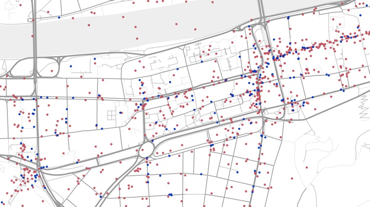
Fig. POIs from different geosocial networks in Heidelberg

Tags: agent-based modelling, data fusion, dfg, quality analysis, social media, spatial analysis, VGI

Posted in OSM, Research, VGI Group

Comments are closed.

  • About

    GIScience News Blog
    News of Heidelberg University’s GIScience Research Group.
    There are 1,484 Posts and 0 Comments so far.

  • Meta

    • Log in
    • Entries RSS
    • Comments RSS
    • WordPress.org
  • Recent Posts

    • Successful PhD Defense by Amin Mobasheri on OSM quality enrichment for wheelchair routing
    • New paper published about the OSM Sketch Map Tool
    • Open Data + Open Software - A perfect match
    • Tagging the main entrances of public buildings based on OpenStreetMap and binary imbalanced learning
    • Press release: Understanding the Spatial and Temporal Dimensions of Landscape Dynamics
  • Tags

    3D 3DGEO Big Spatial Data CAP4Access Citizen Science Colloquium crisis mapping Crowdsourcing data quality disaster DisasterMapping GeoNet.MRN GIScience heigit HOT humanitarian Humanitarian OpenStreetMap team intrinsic quality analysis landuse laser scanning Lidar Mapathon MapSwipe MissingMaps Missing Maps ohsome ohsome example Open data openrouteservice OpenStreetMap OSM OSM History Analytics OSMlanduse Quality quality analysis remote sensing routing social media spatial analysis Teaching terrestrial laser scanning Twitter VGI Wheelchair Navigation Workshop
  • Archives

    • March 2021
    • February 2021
    • January 2021
    • December 2020
    • November 2020
    • October 2020
    • September 2020
    • August 2020
    • July 2020
    • June 2020
    • May 2020
    • April 2020
    • March 2020
    • February 2020
    • January 2020
    • December 2019
    • November 2019
    • October 2019
    • September 2019
    • August 2019
    • July 2019
    • June 2019
    • May 2019
    • April 2019
    • March 2019
    • February 2019
    • January 2019
    • December 2018
    • November 2018
    • October 2018
    • September 2018
    • August 2018
    • July 2018
    • June 2018
    • May 2018
    • April 2018
    • March 2018
    • February 2018
    • January 2018
    • December 2017
    • November 2017
    • October 2017
    • September 2017
    • August 2017
    • July 2017
    • June 2017
    • May 2017
    • April 2017
    • March 2017
    • February 2017
    • January 2017
    • December 2016
    • November 2016
    • October 2016
    • September 2016
    • August 2016
    • July 2016
    • June 2016
    • May 2016
    • April 2016
    • March 2016
    • February 2016
    • January 2016
    • December 2015
    • November 2015
    • October 2015
    • September 2015
    • August 2015
    • July 2015
    • June 2015
    • May 2015
    • April 2015
    • March 2015
    • February 2015
    • January 2015
    • December 2014
    • November 2014
    • October 2014
    • September 2014
    • August 2014
    • July 2014
    • June 2014
    • May 2014
    • April 2014
    • March 2014
    • February 2014
    • January 2014
    • December 2013
    • November 2013
    • October 2013
    • September 2013
    • August 2013
    • July 2013
    • June 2013
    • May 2013
    • April 2013
  •  

    October 2015
    M T W T F S S
    « Sep   Nov »
     1234
    567891011
    12131415161718
    19202122232425
    262728293031  
  • Recent Comments

    GIScience News Blog CC by-nc-sa Some Rights Reserved.

    Free WordPress Themes | Fresh WordPress Themes