
In order to provide emergency and rescue forces in Ecuador with the latest information concerning infrastructural conditions of roads and buildings the Humanitarian OpenStreetMap Team (H.O.T.) as part of the OpenStreetMap Community coordinates the crisis mapping activities for the Ecuador earthquake.
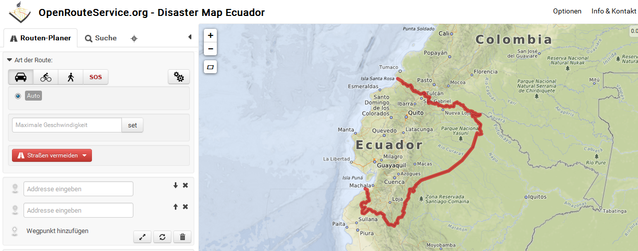
As a first support of these activities the GIScience Heidelberg team set up a OpenStreetMap disaster routing (based on OpenRouteService) and crisis map collecting an visualizing latest OSM information.
The OpenRouteService Disaster Map: http://openls.geog.uni-heidelberg.de/disaster/ and the routing graph will be updated daily.
Most important, as in earlier cases for the disasters in Nepal or Haiti the additional OpenRouteService SOS – route profile currently considers passable and impassable tagged ways (impassable=yes or status=impassable) and dynamically adjusts the graph weights of OSM streets accordingly.
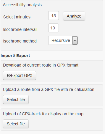
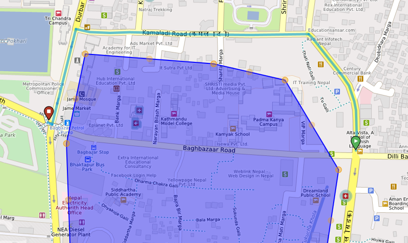
ORS also provides an Accessibility Analysis Service for a given location, the possibility to export GPS tracks to be used offline in mobile device and the interactive Avoid Feature Area Tool (in case areas are severely effected by debris and not accessible at all). These features are thus potentially valuable for Search and Rescue (SAR) units.

![]()
Please have a look at OSM taginfo and the OSM Nepal earthquake wiki to see which disaster related OSM tags and informations are currently edited.
Please share and donate your data to OSM in order to provide NGOs like the UN, Red Cross, THW, MSF and all others with lifesaving information on the ground.
This Thursday we organize a Mapathon for Ecuador at Heidelberg University.
In the next release the map will also provide additional layers which show important emergency related POIs like hospitals, camp sites, rescue stations etc. as well as damaged and collapsed buildings (once the OSM community have tagged these).