• Home
  • About

GIScience News Blog

News of Heidelberg University’s GIScience Research Group.

Feed on
Posts
Comments
« Volunteered geographic (mis)information? Measuring quality in crowdsourced maps - Colloquium Presentation by Andrea Ballatore this Monday
Carlo Ratti from MIT Senseable City Lab talks in Heidelberg today »

OpenRouteService 3.3 is going Mobile - Routing in the Americas, Gradients and more!

Jun 27th, 2016 by Timothy Ellersiek

In our latest release we have primarily focused on optimising and stabilising the backend and on adding new elements to provide an improved user experience throughout the OpenRouteService 3.3 based on OpenStreetMap data.

After many requests from our community, we for starters can happily announce that we have made the service responsive for your mobile smartphones. You are now able to compute your routes when you are on the go.
Furthermore we have changed the styles and layout of the service to ultimately bring the user experience to the next level. Amongst these updates we are happily to feature:

  • A new route summary, now also comprising ascent and descent information for outdoor profiles
  • The possibility to download GPX files containing elevation information provided by the service
  • A more intuitive options menu giving you the option to parameterise your route preferences
  • Several tooltips informing you with hints for the specific buttons

Please feel free to send us any kind of feedback with suggestions or improvements.

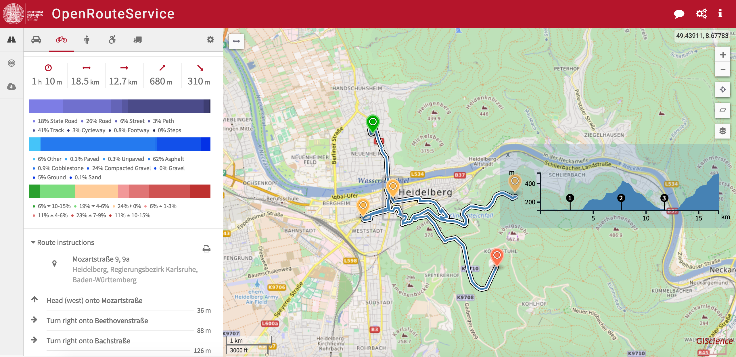
Additionally we have been working on several novel features for all of you outdoor lovers. As you have noticed in our last update we added height information in form of an elevation profile for the bicycle, pedestrian and wheelchair profile. We now actually started to crunch this information to ultimately derive ascent and descent values along the route. By doing so we created a new horizontal chart comprising the specific gradients and its percentages which can be hovered and seen in the map accordingly. As also requested by the ORS community we added via points along the route into the elevation profile to increase the readability.

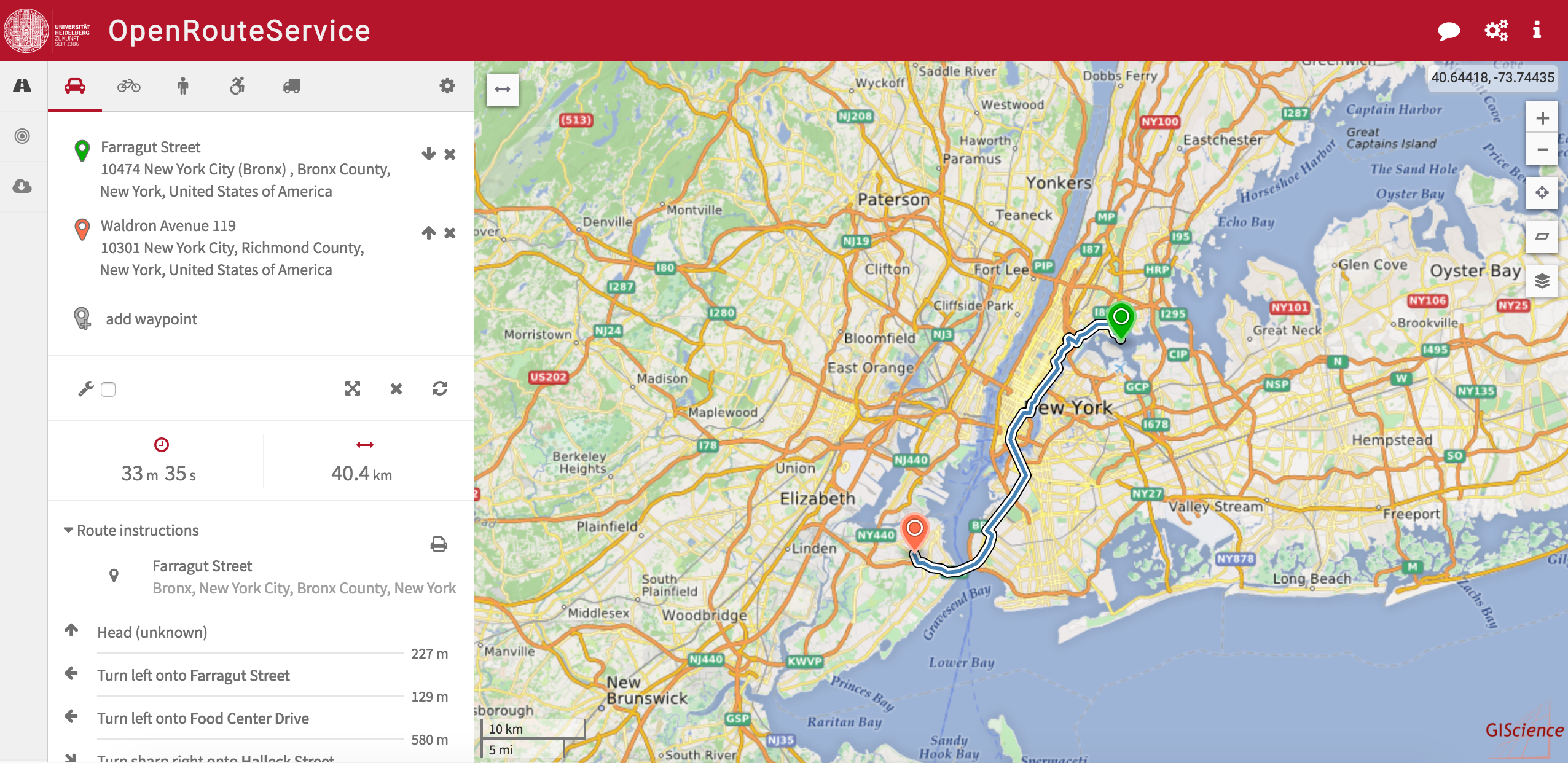
And of course we have been improving the stability of the service. In the course of this we upgraded our backend with additional storage which gives us means to offer you car routing capabilities for North and South America.

Happy Routing!

Links:

  • ORS Issues on GitHub.com
  • OpenRouteService.org
  • Contact us

Tags: openrouteservice, OpenStreetMap, ORS, OSM, rou, routing

Posted in OSM, Research, Services, Software, VGI Group

Comments are closed.

  • About

    GIScience News Blog
    News of Heidelberg University’s GIScience Research Group.
    There are 1,484 Posts and 0 Comments so far.

  • Meta

    • Log in
    • Entries RSS
    • Comments RSS
    • WordPress.org
  • Recent Posts

    • Successful PhD Defense by Amin Mobasheri on OSM quality enrichment for wheelchair routing
    • New paper published about the OSM Sketch Map Tool
    • Open Data + Open Software - A perfect match
    • Tagging the main entrances of public buildings based on OpenStreetMap and binary imbalanced learning
    • Press release: Understanding the Spatial and Temporal Dimensions of Landscape Dynamics
  • Tags

    3D 3DGEO Big Spatial Data CAP4Access Citizen Science Colloquium crisis mapping Crowdsourcing data quality disaster DisasterMapping GeoNet.MRN GIScience heigit HOT humanitarian Humanitarian OpenStreetMap team intrinsic quality analysis landuse laser scanning Lidar Mapathon MapSwipe MissingMaps Missing Maps ohsome ohsome example Open data openrouteservice OpenStreetMap OSM OSM History Analytics OSMlanduse Quality quality analysis remote sensing routing social media spatial analysis Teaching terrestrial laser scanning Twitter VGI Wheelchair Navigation Workshop
  • Archives

    • March 2021
    • February 2021
    • January 2021
    • December 2020
    • November 2020
    • October 2020
    • September 2020
    • August 2020
    • July 2020
    • June 2020
    • May 2020
    • April 2020
    • March 2020
    • February 2020
    • January 2020
    • December 2019
    • November 2019
    • October 2019
    • September 2019
    • August 2019
    • July 2019
    • June 2019
    • May 2019
    • April 2019
    • March 2019
    • February 2019
    • January 2019
    • December 2018
    • November 2018
    • October 2018
    • September 2018
    • August 2018
    • July 2018
    • June 2018
    • May 2018
    • April 2018
    • March 2018
    • February 2018
    • January 2018
    • December 2017
    • November 2017
    • October 2017
    • September 2017
    • August 2017
    • July 2017
    • June 2017
    • May 2017
    • April 2017
    • March 2017
    • February 2017
    • January 2017
    • December 2016
    • November 2016
    • October 2016
    • September 2016
    • August 2016
    • July 2016
    • June 2016
    • May 2016
    • April 2016
    • March 2016
    • February 2016
    • January 2016
    • December 2015
    • November 2015
    • October 2015
    • September 2015
    • August 2015
    • July 2015
    • June 2015
    • May 2015
    • April 2015
    • March 2015
    • February 2015
    • January 2015
    • December 2014
    • November 2014
    • October 2014
    • September 2014
    • August 2014
    • July 2014
    • June 2014
    • May 2014
    • April 2014
    • March 2014
    • February 2014
    • January 2014
    • December 2013
    • November 2013
    • October 2013
    • September 2013
    • August 2013
    • July 2013
    • June 2013
    • May 2013
    • April 2013
  •  

    June 2016
    M T W T F S S
    « May   Jul »
     12345
    6789101112
    13141516171819
    20212223242526
    27282930  
  • Recent Comments

    GIScience News Blog CC by-nc-sa Some Rights Reserved.

    Free WordPress Themes | Fresh WordPress Themes