
The MapSwipe app allows you to mark buildings and roads on satellite imagery within
just a few seconds by tapping on your smartphone. Thousands of volunteers contributed to
MapSwipe so far and it is just incredible how big the areas are that have been scanned (also see : With one swipe or tap you put a family on the map and MapSwipe App for humanitarian mapping features in Product Hunt today).
Nevertheless, classifying satellite imagery cannot replace the “traditional” mapping process.
The information on settlements or highways provides the most value to everyone if it is present in the OpenStreetMap database. Consequently, we need a smooth way to integrate the MapSwipe data into the OSM Mapping workflow using the HOT Tasking Manager.
The GIScience Research Group and the disatermappers heidelberg are happy to show a
workflow that allows the frictionless integration of crowdsourced image classification
for the HOT Tasks generation. As the MapSwipe data already indicates where mapping is
needed, we can use the information to define the areas of interest, that will represent
the single mapping tasks in the HOT Tasking Manager. This approach also follows the
“Heidelberg Process“, which aims to break down mapping into single subtasks, which are
based upon each other.
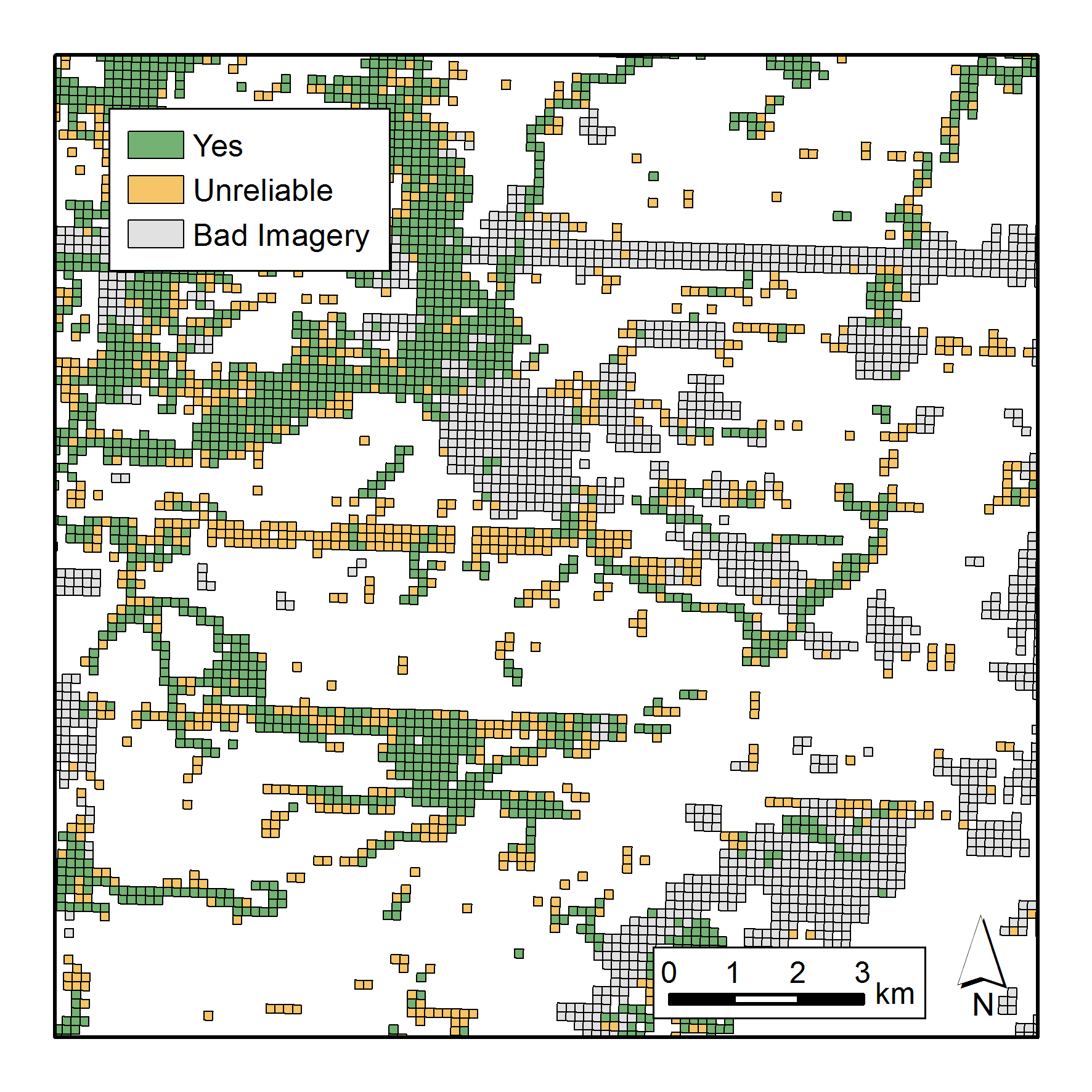
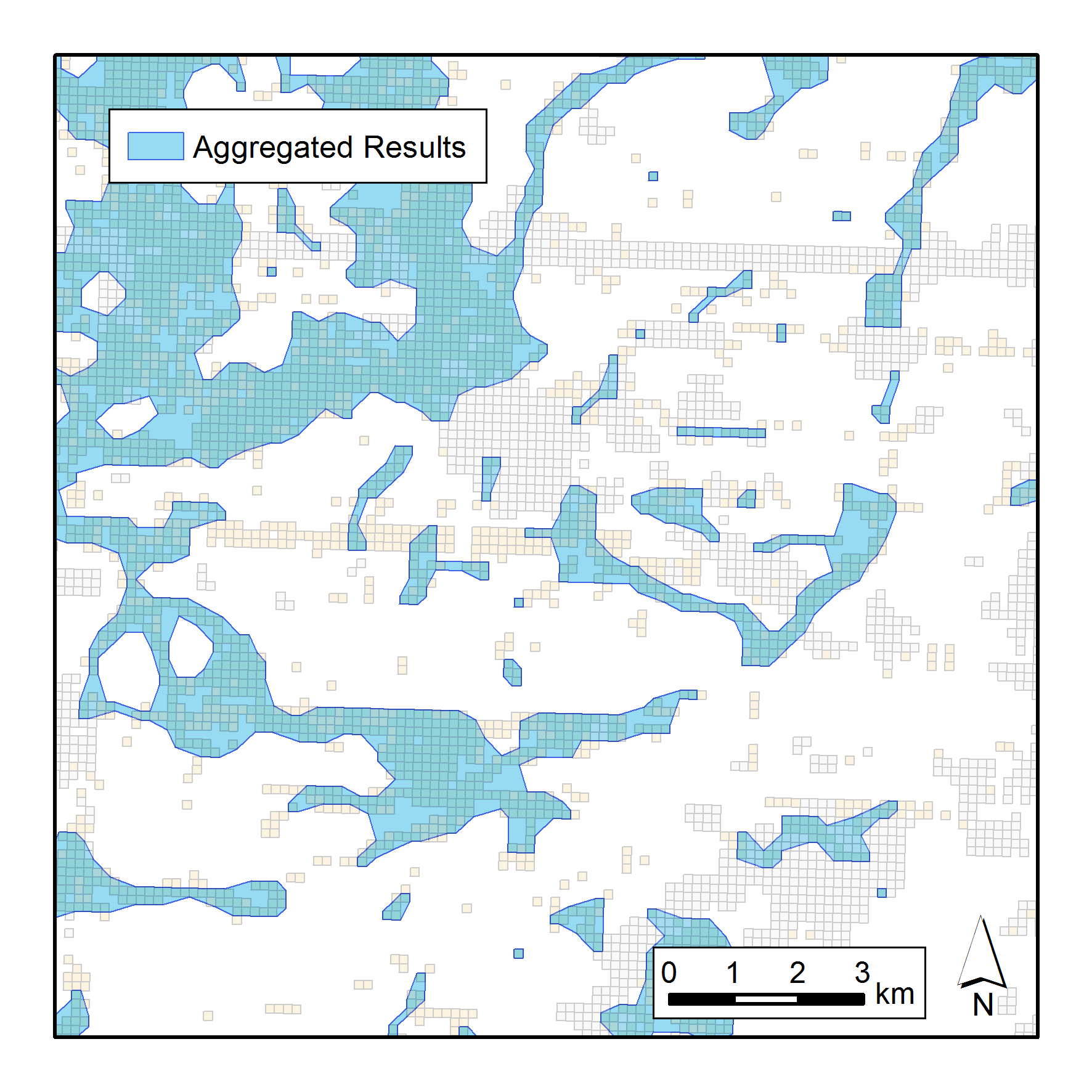
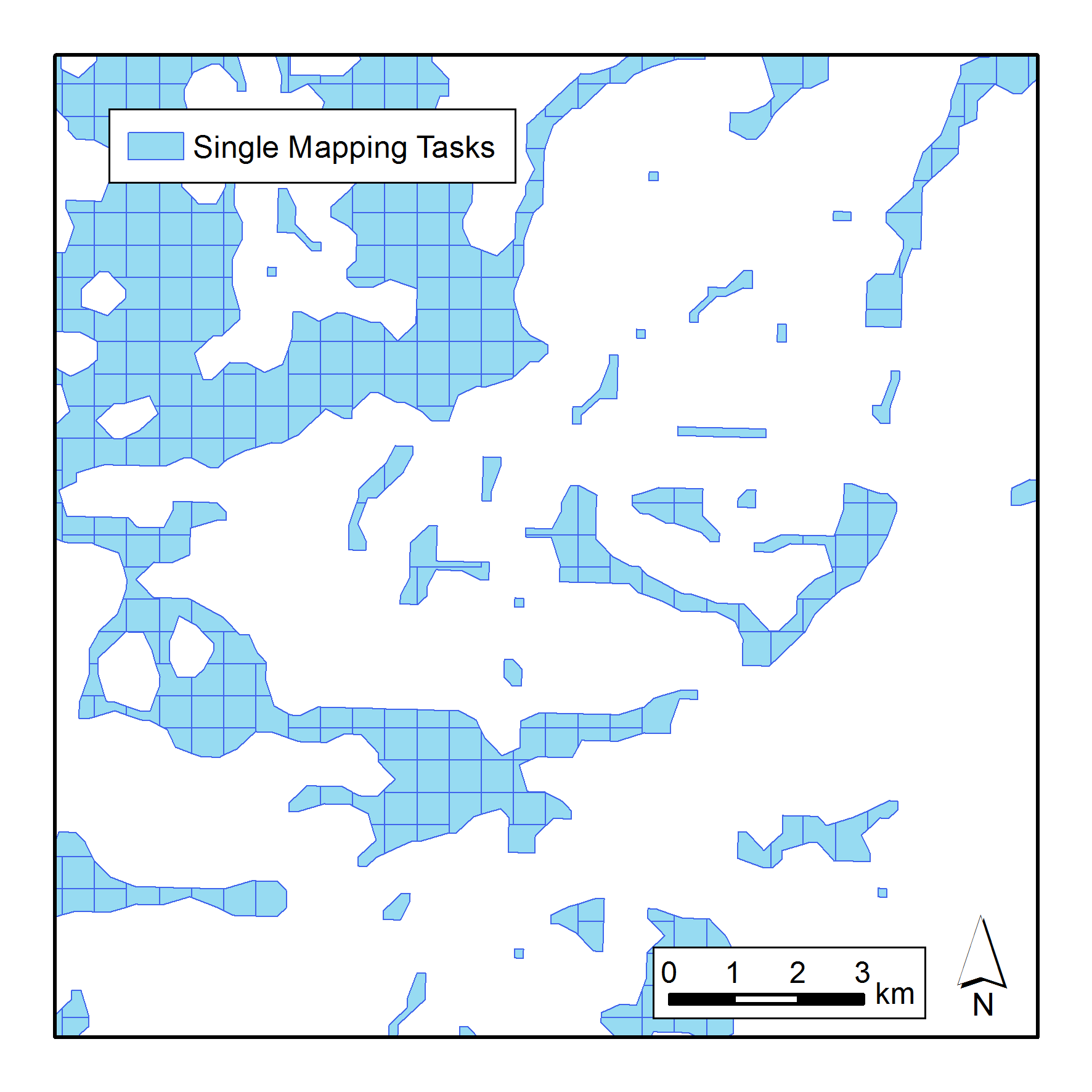
There are three steps conducted that are displayed below:
1. Get MapSwipe raw data and select “credible” tiles with features
2. Aggregate results
3. Split aggregated results to ares that are ready to use in the Tasking Manager
We set up a gitlab with scripts for downloading and processing MapSwipe raw data [Check it out here].
In addition we provide downloaded and processed data via cloud storage (updated 48h) [Get the data here].
The processed, “final” data is in shapefile format. Before creating a HOT TM project out of it two steps are important.
First, get relevant data by clipping the respective mapswipe project with a geometry of your desired region (e.g. administrative boundaries). The extent of MapSwipe projects are very huge, better not use it as a whole HOT TM project. That step is very simple with QGIS, just load the “final_<projectNR>.shp” and your region of interest in and use Vector>>Geoprocessing Tools>>Clip. Now you got your tasks ready for create the HOT TM project. Upload it and don’t forget to click on “arbitrary polygons”.
The project is created, editing in ID works fine but theres one last thing missing. Because of the arbitrary polygons, mappers who don’t use ID will not see the boundary of their task when editing. It’s therefore likely that some of the mappers will map objects which are located in another task. To solve this issue, you just need to provide a .gpx file containing the shapes of the tasks.
In QGIS run Vector>>Geometry Tools>>Polygons to Lines and use your clipped shapefile as input. The output file fulfills all requirements to be saved as .gpx. Upload this file to a accessible storage like dropbox or gdrive and copy the link for download in the instructions tab of your HOT project. Be sure that everyone who want to contribute will be aware that this file is needed as additional layer in their editor!
We set up the first HOT Mapping Task that uses the MapSwipe data for MSF in Madagascar.
Given the information from MapSwipe, OSM mappers can now focus on the areas that are populated and don’t have to spend valuable time scanning unpopulated areas and areas with poor imagery. Doing so, mapping becomes even more fun. 😉
Interested to try this process yourself and to learn more about MapSwipe, Mapping and the MSF activation in Madagascar? Then join us for our OSMGeoWeek Missing Maps Mapathon for Madagascar tomorrow, 17th November from 6pm in the lecture hall, Berliner Straße 48.
No previous knowledge necessary, just bring your own laptop and a mouse if available!