
Since the launch of the MapSwipe Analytics webpage three month ago we were able to improve our service and offer more detailed information on each project in MapSwipe. MapSwipe is a mobile App for crowdsourcing geographic information needed by humanitarian organisations like Red Cross and Doctors without Borders (MSF) introduced earlier. In particular the data can be used for priorizing areas within the HOT Tasking Manager.
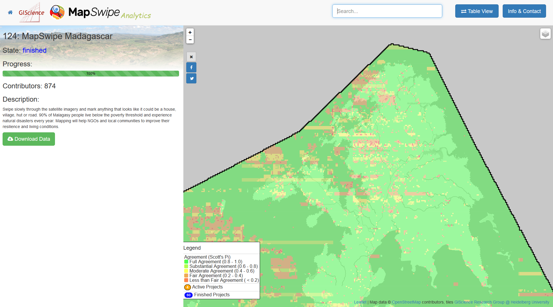
Especially the new “agreement” layer helps to understand the quality of the MapSwipe data. Agreement values close to 1.0 indicate that there is a high agreement amongst volunteers. Vice versa, values close to 0 show that the MapSwipe volunteers disagreed. By using this layer we are able to find out, which areas need more attention in the mapping process.
Additionally you can toggle between the “Yes”, “Maybe” and “Bad Image” layers to visualize the number of contributions in each class. The “Progress” layer helps you to track the status of the project and depicts which areas are already covered and which areas are still to map.
Furthermore, we had a closer look at our mapping community. In total more than 16,000 people contributed to MapSwipe. However, not everyone is contributing equally. A special “Thank You!” goes to the long-term mappers, who are the backbone of MapSwipe and contribute most of the data. But also “MapSwipe Mapathons” are a great way to contribute and generate a lot of data (up to 50,000 results per day!), that is used to delineate populated areas.

So, dear MapSwipers please continue with you great efforts and tell you friends and family to use MapSwipe. 🙂
We recently launched the “MapSwipe Working Group” under the umbrella of the HOT Technology Working Group. If you are interested in becoming an active part of the developers community, don’t hesitate to contact us and have a look at the MapSwipe github repository.
🙂
Further references:
Herfort, B., Reinmuth, M., Porto de Albuquerque, J., Zipf, A. (2017): Towards evaluating the mobile crowdsourcing of geographic information about human settlements. 20th AGILE conference 2017, Wageningen, Netherlands.
Herfort B, Eckle M, Reinmuth M et al. The democratisation of humanitarian mapping: insights into the MapSwipe app and data quality [version 1; not peer reviewed]. F1000Research 2017, 6:704 (slides) (doi: 10.7490/f1000research.1114077.1)
MSF Scientific Days Talk on Youtube: https://youtu.be/Oxu5M6gzvuo
This work has kindly been supported by the Klaus Tschira Foundation, Heidelberg through the core-funding for HeiGIT (Heidelberg Institute for Geoinformation Technology).