
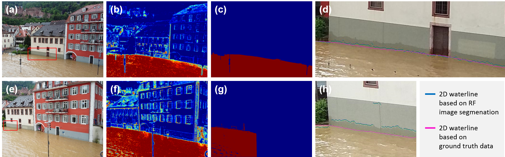
In our recently published study “Direct local building inundation depth determination in 3-D point clouds from user-generated flood images” we present a new approach for deriving local building inundation depth from ordinary user-generated flood images captured during a flood event. After reconstructing a 3-D scene of the building of interest with close-range photogrammetry (CRP) algorithms, the flood line shown in the flood image is mapped into this 3-D scene and, thus, allows the derivation of inundation measurements. The acquired accuracy of building inundation depth with our automatic approach is 0.13 m ± 0.10 m. This result shows, that user-generated images are a valid, complementary data source for flood documentation.
Griesbaum, L., Marx, S. & Höfle, B. (2017): Direct local building inundation depth determination in 3-D point clouds generated from user-generated flood images. Natural Hazards and Earth System Sciences, 17 (7), pp. 1191-1201. DOI: 10.5194/nhess-17-1191-2017