
The Klimaschutzkarte Deutschland (Climate Protection Map Germany, www.Klimaschutzkarte.de) makes it easy to retrieve relevant information on the topics of energy and sustainability and to locate them in geographic space. The Climate Protection Map of Germany uses the possibilities of web technologies and is based on user-contributed data from OpenStreetMap to allow interested citizens to find out about topics such as sustainable energy supply, mobility forms and consumption / nutrition etc., which are all related to climate protection and sustainability.
Better information is the first step for the right action. Also YOU can contribute to climate protection through a more sustainable lifestyle! The Climate Protection Map Germany helps you to do this by showing where you can find e.g. healthy bio food, renewable energy or where to repair broken goods instead of throwing them to the waste and buying new stuff. Contribute your local knowledge about the five identified dimensions of climate protection to OpenStreetMap and raise the awareness of everyone on these important topics for society. Thanks to all OSM contributors for making this possible!
The five main dimensions provided by the map are at the moment the following. Each category can have several layers of information (see at the map):
– Energy Policy (e.g. Initatives and clubs)
– Energy Supply (e.g.Biogas-powerplants, gas storages, geothermal facilities etc.)
– Living and Construction (Proxy for house heating demand: Building Surface-Are to Volume Ratio, for Heidelberg only)
– Mobility and Traffic (e.g. Rent-a-bike-Stations, E-mobility charging stations, Car Sharing Places etc.)
– Food and Consumption (e.g. Organic Supermarkets, Farm Shops, Repair Shops or Second-Hand Shops)
Individual regions can be compared to one another, and a greater awareness of citizens’ climate protection and energy needs is created.
The Klimaschutzkarte Deutschland has been realized by GIScience Heidelberg in cooperation with ifeu Heidelberg (Institute for Energy and Environment Heidelberg) and it is funded by Ministerium für Wissenschaft, Forschung und Kunst Baden-Württemberg, Germany. The current version only covers Germany, but we work on extending this for Europe and beyond.
Fig: Map and Layer-Structure:
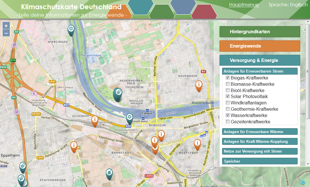
Fig: UserInterface for energy and sustainability topics:
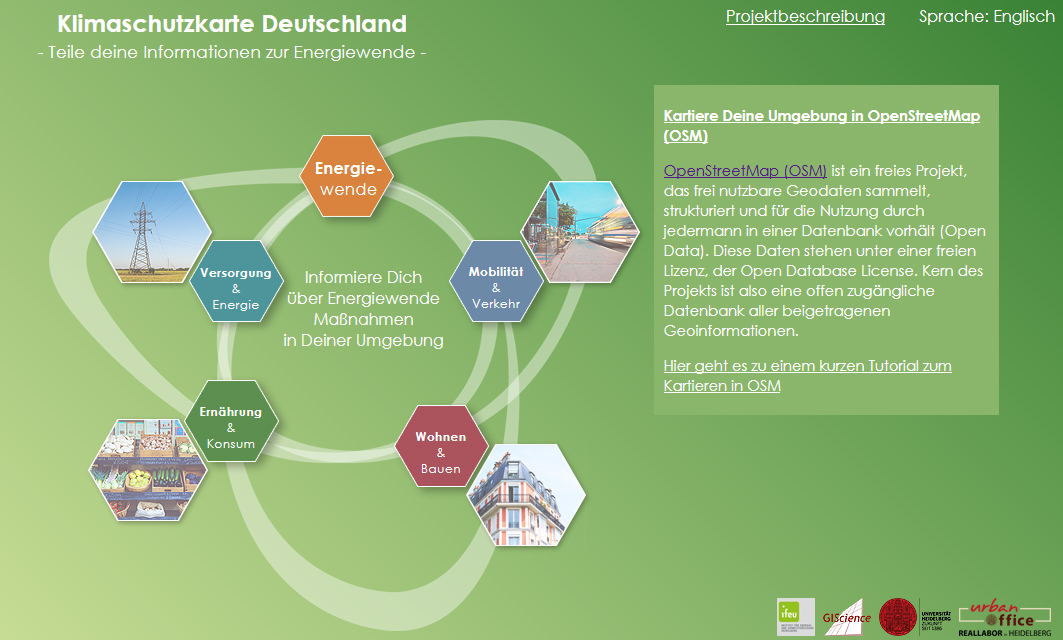
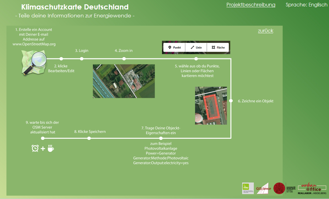
Fig: Mapping Instructions for OpenStreetMap:
The project has been funded by the Ministry of Science, Research and Art, Baden-Württemberg.