
The Humanitarian OpenStreetMap Team (HOT) provides immediate support for disaster or humanitarian responses by coordinating and activating a global network of mappers that contribute up-to-date geodata to the OSM database. For example, after the Nepal earthquake 2015 volunteers added up to 800 km to the OSM street network per hour! This information could successfully support post-disaster humanitarian logistics on the ground.
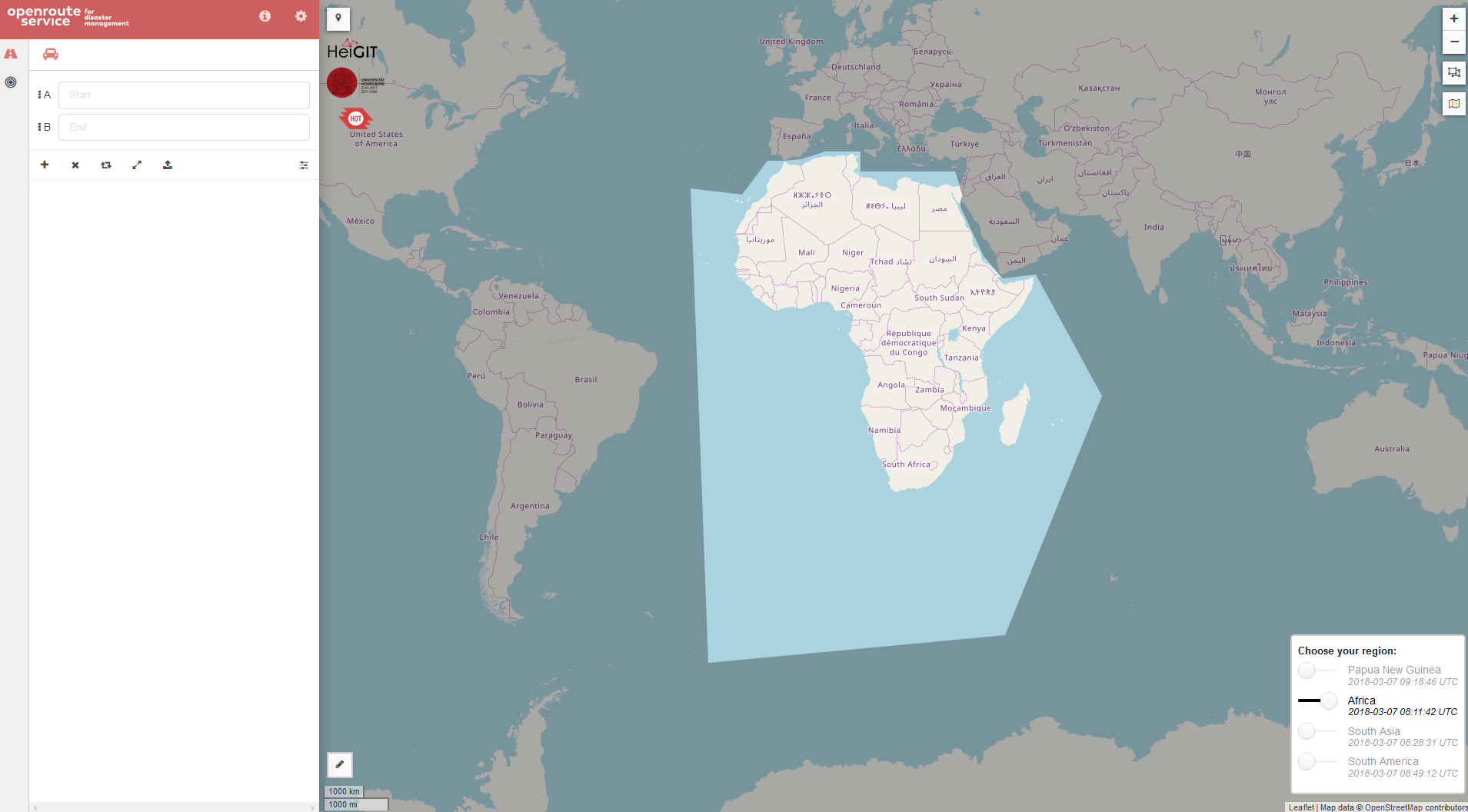
To consider always the latest OSM data available, the Openrouteservice for Disaster Management by HeiGIT now provides updates more frequently. The entire African continent, South America and South Asia are available as stable instances with hourly update intervals. Papua New Guinea, which was recently hit by a severe earthquake, is furthermore currently integrated with an even higher update interval of 15 minutes to support the direct disaster response. In case of major disasters which affect regions not covered by our service, new areas can be added by our team on request.
The Real-time OSM we introduced recently, is used to access up-to-date OSM extracts on which basis the routing graphs are recalculated. Have a look at the github repo to get more insights on real-time OSM and test our service at disaster.openrouteservice.org.
HeiGIT is supported by the Klaus Tschira Foundation, Heidelberg.

Selected Related Work:
- Neis, P., Singler, P. & Zipf, A. (2010): Collaborative mapping and Emergency Routing for Disaster Logistics – Case studies from the Haiti earthquake and the UN portal for Afrika. In: Car, A., Griesebner, G. & Strobl, J. (Eds.): Geospatial Crossroads @ GI_Forum ’10. Proceedings of the Geoinformatics Forum Salzburg.
- Eckle, M., Herfort, B., Alberquerque, R. Leiner, R. Wolff, C. Jacobs, J. P., Zipf, A. (2016): Leveraging OpenStreetMap to support flood risk management: A prototype decision support system for the identification of critical infrastructure. 13th International Conference on Information Systems for Crisis Response and Management. ISCRAM 2016. Rio de Janeiro, Brazil
- Schmitz, S., Neis, P. & Zipf, A. (2008): New Applications based on Collaborative Geodata – the Case of Routing. XXVIII INCA International Congress on Collaborative Mapping and SpaceTechnology, Gandhinagar, Gujarat, India.
- Haase M., Zipf, A., Neis, P., de Camargo, V. (2008): Interoperable Routing Services in the Context of Evacuation Schemes due to Urban Flooding.EnviroInfo 2008 Conference. Environmental Informatics and Industrial Ecology. Lueneburg, Germany.
- Miksch, J., Hahmann, S., Resch, B., Lauer, J., Zipf, A. (2017): Routing Through Open Spaces – A Performance Comparison Of Algorithms. Geo-Spatial information Science, 2017. Taylor & Francis. Geo-Spatial information Science, 2017. Taylor & Francis. https://doi.org/10.1080/10095020.2017.1399675
- Neis, P., Schilling, A. & Zipf, A. (2007): 3D Emergency Route Service (3D-ERS) based on OpenLS Specifications. GI4DM 2007. 3rd International Symposium on Geoinformation for Disaster Management. Toronto, Canada
- Bakillah, M., Lauer, J., Liang, S., Zipf, A., Jokar Arsanjani, J., Mobasheri, A. & Loos, L. . (2014): Exploiting Big VGI to Improve Routing and Navigation Services. In: Karimi, H.: Big Data Techniques and Technologies in Geoinformatics.
- Weiser, A. & Zipf, A. (2007): Web Service Orchestration (WSO) of OGC Web Services (OWS) for Disaster Management. GI4DM 2007. 3rd International Symposium on Geoinformation for Disaster Management. Toronto, Canada
- Lauer, J., Bakillah, M., Liang, S.H.L. & Zipf, A. (2012): Toward a Reasoning Service to Improve Routable Road Maps by Deriving Road Attributes from Telematics Data. Workshop: “Progress in Movement Analysis – Experiences with Real Data”. Zuerich. Switzerland.
- Brinkhoff, T., Bertling, M., Biermann, J., Gervens, T., König, R., Kümper, D., Neis, P., Stollberg, B., Rolfs, C., Weiser, A., Weitkämpfer, J. & Zipf, A. (2008): Offenes Katastrophenmanagement mit freiem GIS Zur interoperablen Kopplung von Leitstellensystem, mobilen Clienten und GDI mit Prozessierungsdiensten. AGIT 2008. Symposium für angewandte Geoinformatik. Salzburg. Austria.