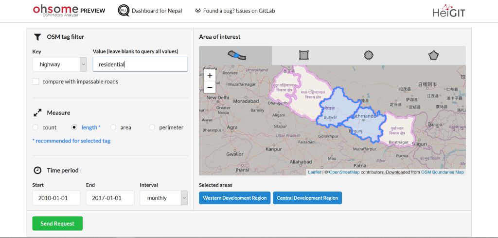
The Ohsome Nepal Dashboard has new features to enhance its usability and functionality. The user can now easily select administrative areas of interest through a new map interface. Different administrative levels can be selected by zooming in and out and afterwards just clicking or tapping on that specific region. This convenience feature makes it much faster to express a spatial interest during an analysis of disaster relevant features. The underlying border data originates from OpenStreeMap and has been provided by OSM Boundaries Map. Alternatively areas of interests can still be expressed as bounding boxes, circles or polygons.
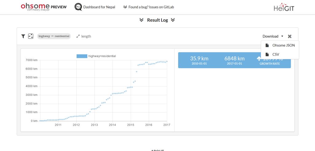
Another new option is now available, which allows the user to download the results of an analysis for further usage. The user can choose between different formats (JSON or CSV).
The Ohsome Nepal Dashboard uses the Ohsome OSM History Analytics Framework, especially the Ohsome API currently developed at HeiGIT to query spatio-temporal aspects of disaster related data. (Find further information in the release post here: A preview of the Ohsome Nepal dashboard)