• Home
  • About

GIScience News Blog

News of Heidelberg University’s GIScience Research Group.

Feed on
Posts
Comments
« ER3DS Makes Cities Smarter
Announcement of an Open Research Position »

Kick-Off Waterproofing Data project in São Paulo, Brazil

Nov 30th, 2018 by GIScienceHD

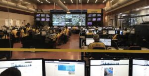
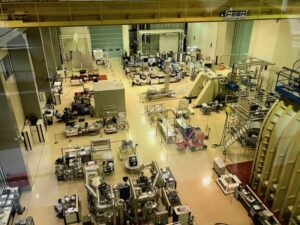
This month we kicked off our new project Waterproofing Data in São Paulo, Brazil together with partners from Warwick University and Brazilian stakeholders such as Cemaden (National Early Warning and Monitoring Centre for Natural Disasters / Centro Nacional de Monitoramento e Alertas de Desastres Naturais) or local Universities, City of São Paulo, Fundacao Getulio Varga etc. We also visited colleagues at INPE (Brasilian Space Agency; Instituto Nacional de Pesquisas Espaciais) in São José dos Campos for joint research and collaborations.

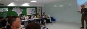
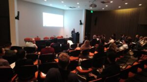
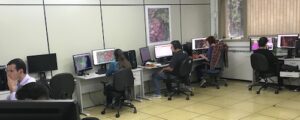
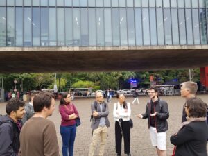
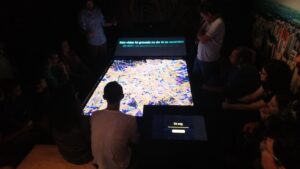
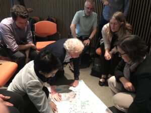
See some impressions from the intense week below where we had internal meetings and workshops as well as public Kick-off and presentations and interactive engagement with lokal stakeholders (including the local OpenStreetMap community), visits to some study sites and collaborative work in the centers of expertise.


The project investigates the governance of water-related risks, with a focus on social and cultural aspects of data practices. Typically, data flows up from local levels to scientific “centres of expertise”, and then flood-related alerts and interventions flow back down through local governments and into communities. Rethinking how flood-related data is produced, and how it flows, can help build sustainable, flood resilient communities.To this end, this project develops three innovative methods around data practices, across different sites and scales:

1) we will make visible existing flows of flood-related data through tracing data;

2) generate new types of data at the local level by engaging citizens through the creation of multi-modal interfaces, which sense, collect and communicate flood data, and;

3) integrate citizen-generated data with other data using geo-computational techniques.

These methodological interventions will transform how flood-related data is produced and flows, creating new governance arrangements between citizens, governments and flood experts and, ultimately, increased community resilience related to floods in vulnerable communities of Sao Paulo and Acre, Brazil.

The project will be conducted by a international team of researchers with multiple disciplinary backgrounds from Brazil, Germany and the UK, in close partnership with researchers, stakeholders and publics of a multi-site case study on flood risk management in Brazil. Furthermore, the methods and results of this case study will be the basis for a transcultural dialogue with government organisations and local administration involved in flood risk management in Germany (GIScience Heidelberg) and the United Kingdom (Warwick, J.Porto).

Funding: EU, Belmont Forum and NORFACE joint programme Transformations to Sustainability (T2S)

Tags: Citizen Science, data quality, disaster risk management, flood, OpenStreetMap, OSM, perception, risk perception, sketch map, VGI

Posted in Events, Research

Comments are closed.

  • About

    GIScience News Blog
    News of Heidelberg University’s GIScience Research Group.
    There are 1,131 Posts and 9 Comments so far.

  • Meta

    • Log in
    • Entries RSS
    • Comments RSS
    • WordPress.org
  • Recent Posts

    • How to become ohsome part 3: Identifying different mapping schemes
    • HeiGIT and German Red Cross representation at DLR Humanitarian Technology Days 2019
    • HeiGIT at German Red Cross “Digitalisation in Civil Protection” congress
    • How can LiDAR data help to understand early Olmec subsistence in Mexico?
    • New Highlights at STAP19
  • Tags

    3D AGILE Big Spatial Data CAP4Access Citizen Science Colloquium crisis mapping Crowd Analyser Crowdsourcing data quality disaster DisasterMapping GeoNet.MRN GIScience heigit humanitarian Humanitarian OpenStreetMap team intrinsic quality analysis landuse laser scanning Lidar Mapathon MapSwipe MissingMaps Missing Maps ohsome Open data OpenRouteService OpenStreetMap OSM OSM History Analytics OSMlanduse Quality quality analysis remote sensing routing social media spatial analysis Teaching Twitter VGI WebGIS wheelchair Wheelchair Navigation Workshop
  • Archives

    • February 2019
    • January 2019
    • December 2018
    • November 2018
    • October 2018
    • September 2018
    • August 2018
    • July 2018
    • June 2018
    • May 2018
    • April 2018
    • March 2018
    • February 2018
    • January 2018
    • December 2017
    • November 2017
    • October 2017
    • September 2017
    • August 2017
    • July 2017
    • June 2017
    • May 2017
    • April 2017
    • March 2017
    • February 2017
    • January 2017
    • December 2016
    • November 2016
    • October 2016
    • September 2016
    • August 2016
    • July 2016
    • June 2016
    • May 2016
    • April 2016
    • March 2016
    • February 2016
    • January 2016
    • December 2015
    • November 2015
    • October 2015
    • September 2015
    • August 2015
    • July 2015
    • June 2015
    • May 2015
    • April 2015
    • March 2015
    • February 2015
    • January 2015
    • December 2014
    • November 2014
    • October 2014
    • September 2014
    • August 2014
    • July 2014
    • June 2014
    • May 2014
    • April 2014
    • March 2014
    • February 2014
    • January 2014
    • December 2013
    • November 2013
    • October 2013
    • September 2013
    • August 2013
    • July 2013
    • June 2013
    • May 2013
    • April 2013
  •  

    November 2018
    M T W T F S S
    « Oct   Dec »
     1234
    567891011
    12131415161718
    19202122232425
    2627282930  
  • Recent Comments

    • Hier on Long-expected major Update on OpenRouteService with many new features in backend and frontend
    • forum on OpenStreetMap and Mapsurfer.NET help to search for missing people
    • nedir on Long-expected major Update on OpenRouteService with many new features in backend and frontend
    • René on Long-expected major Update on OpenRouteService with many new features in backend and frontend
    • Kai Brunner on OpenStreetMap and Mapsurfer.NET help to search for missing people

GIScience News Blog CC by-nc-sa Some Rights Reserved.

Free WordPress Themes | Fresh WordPress Themes