
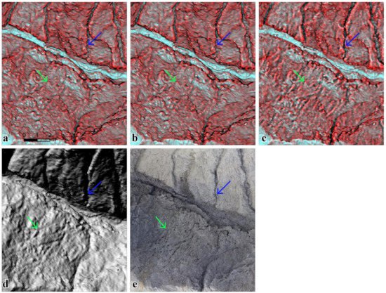
Topographic parameters of high-resolution digital elevation models (DEMs) with meter to sub-meter spatial resolution, such as slope, curvature, openness, and wetness index, show the spatial properties and surface characterizations of terrains. The multi-parameter relief map, including two-parameter (2P) or three-parameter (3P) information, can visualize the topographic slope and terrain concavities and convexities in the hue, saturation, and value (HSV) color system. Various combinations of the topographic parameters can be used in the relief map, for instance, using wetness index for upstream representation. In particular, 3P relief maps are integrated from three critical topographic parameters including wetness or aspect, slope, and openness data. This study offers an effective way to explore the combination of topographic parameters in visualizing terrain features using multi-parameter relief maps in badlands and in showing the effects of smoothing and parameter selection. The multi-parameter relief images of high-resolution DEMs clearly show micro-topographic features, e.g., popcorn-like morphology and rill.
- Chu, H.-J., Chen, Y.-C., Ali, M.Z. & Höfle, B. (2019): Multi-Parameter Relief Map from High-Resolution DEMs: A Case Study of Mudstone Badland. International Journal of Environmental Research and Public Health. Vol. 16 (7), pp. 1-12.