• Home
  • About

GIScience News Blog

News of Heidelberg University’s GIScience Research Group.

Feed on
Posts
Comments
« Prize for best PhD for Rene Westerholt “Förderpreis Runder Tisch GIS München”
TdLab Geography contributed to Heidelberg Physics Graduate Days »

OpenStreetMap History Database – version 0.5

Apr 9th, 2019 by Martin Raifer

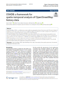
The OpenStreetMap History Database (OSHDB) is what powers most of the functionality of HeiGIT’s ohsome platform. The ohsome API for example, which was often showcased here in the blog, is built on top of the OSHDB. Just recently, an open access software article about the OSHDB was published. Check it out to find out more about the conceptual and technical background behind the OSHDB!

The newest version of the OSHDB is 0.5.0 and forms an important milestone on our way to provide you with the perfect tool to analyse OSM history data. Here are the three most important highlights of this release:

  1. Stability and performance: The main goal was to make the OSHDB framework more stable and more performant. It can now handle the global OSM full history dataset (which is big) with ease. This allows for example everyone to explore the evolution of the OSM project, or to answer research questions about OSM history data.
  2. New features: There are also a couple of new features included in the new release, for example the possibility to calculate median and quantiles, a completely rewritten and much more flexible way to calculate aggregated result for arbitrary subsets of the queried OSM data including a way to aggregate results by sub-regions.
  3. Documentation: Last but not least, the project repository finally got a proper documentation section that explains the concepts and features of the OSHDB in detail.

Take a look at our changelog of version 0.5 to see the full list of all major changes in this version. If you’re upgrading from a previous version of the OSHDB: note that we updated some of our dependencies and that the central libary JTS is now maintained by a different company. This means that you might have to adjust import statements as explained in their JTS migration guide.

You can find the OSHDB source code as open-source under the LGPLv3 license on github. Don’t hesitate to open a ticket there if you encounter any bugs or are missing a particular feature in the OSHDB and feel free to contact us via email to info@heigit.org.

Please cite this reference paper if you are using the ohsome plattform and oshdb in particular:

Raifer, M, Troilo, R, Kowatsch, F, Auer, M, Loos, L, Marx, S, Przybill, K, Fendrich, S, Mocnik, FB & Zipf, A (2019): OSHDB: a framework for spatio-temporal analysis of OpenStreetMap history data. Open Geospatial Data, Software and Standards, https://doi.org/10.1186/s40965-019-0061-3.

Earlier work on using the platform, see e.g.:

Auer, M.; Eckle, M.; Fendrich, S.; Griesbaum, L.; Kowatsch, F.; Marx, S.; Raifer, M.; Schott, M.; Troilo, R.; Zipf, A. (2018): Towards Using the Potential of OpenStreetMap History for Disaster Activation Monitoring. ISCRAM 2018. Rochester. NY. US.

Tags: Big Data, Big Spatial Data, ohsome, OpenStreetMap, oshdb, OSM, OSM History Analytics

Posted in OSM, Publications, Software

Comments are closed.

  • About

    GIScience News Blog
    News of Heidelberg University’s GIScience Research Group.
    There are 1,484 Posts and 0 Comments so far.

  • Meta

    • Log in
    • Entries RSS
    • Comments RSS
    • WordPress.org
  • Recent Posts

    • Successful PhD Defense by Amin Mobasheri on OSM quality enrichment for wheelchair routing
    • New paper published about the OSM Sketch Map Tool
    • Open Data + Open Software - A perfect match
    • Tagging the main entrances of public buildings based on OpenStreetMap and binary imbalanced learning
    • Press release: Understanding the Spatial and Temporal Dimensions of Landscape Dynamics
  • Tags

    3D 3DGEO Big Spatial Data CAP4Access Citizen Science Colloquium crisis mapping Crowdsourcing data quality disaster DisasterMapping GeoNet.MRN GIScience heigit HOT humanitarian Humanitarian OpenStreetMap team intrinsic quality analysis landuse laser scanning Lidar Mapathon MapSwipe MissingMaps Missing Maps ohsome ohsome example Open data openrouteservice OpenStreetMap OSM OSM History Analytics OSMlanduse Quality quality analysis remote sensing routing social media spatial analysis Teaching terrestrial laser scanning Twitter VGI Wheelchair Navigation Workshop
  • Archives

    • March 2021
    • February 2021
    • January 2021
    • December 2020
    • November 2020
    • October 2020
    • September 2020
    • August 2020
    • July 2020
    • June 2020
    • May 2020
    • April 2020
    • March 2020
    • February 2020
    • January 2020
    • December 2019
    • November 2019
    • October 2019
    • September 2019
    • August 2019
    • July 2019
    • June 2019
    • May 2019
    • April 2019
    • March 2019
    • February 2019
    • January 2019
    • December 2018
    • November 2018
    • October 2018
    • September 2018
    • August 2018
    • July 2018
    • June 2018
    • May 2018
    • April 2018
    • March 2018
    • February 2018
    • January 2018
    • December 2017
    • November 2017
    • October 2017
    • September 2017
    • August 2017
    • July 2017
    • June 2017
    • May 2017
    • April 2017
    • March 2017
    • February 2017
    • January 2017
    • December 2016
    • November 2016
    • October 2016
    • September 2016
    • August 2016
    • July 2016
    • June 2016
    • May 2016
    • April 2016
    • March 2016
    • February 2016
    • January 2016
    • December 2015
    • November 2015
    • October 2015
    • September 2015
    • August 2015
    • July 2015
    • June 2015
    • May 2015
    • April 2015
    • March 2015
    • February 2015
    • January 2015
    • December 2014
    • November 2014
    • October 2014
    • September 2014
    • August 2014
    • July 2014
    • June 2014
    • May 2014
    • April 2014
    • March 2014
    • February 2014
    • January 2014
    • December 2013
    • November 2013
    • October 2013
    • September 2013
    • August 2013
    • July 2013
    • June 2013
    • May 2013
    • April 2013
  •  

    April 2019
    M T W T F S S
    « Mar   May »
    1234567
    891011121314
    15161718192021
    22232425262728
    2930  
  • Recent Comments

    GIScience News Blog CC by-nc-sa Some Rights Reserved.

    Free WordPress Themes | Fresh WordPress Themes