
Today, June 5 is the #WorldEnvironmentDay. World Environment Day is the United Nations day for encouraging worldwide awareness and action to protect our #environment. Above all, World Environment Day is the “people’s day” for doing something to take care of the Earth. That “something” can be local, national or global. This is a good opportunity to remind about the global OSM Climate Protection Map at Klimaschutzkarte.de by GIScience Heidelberg.
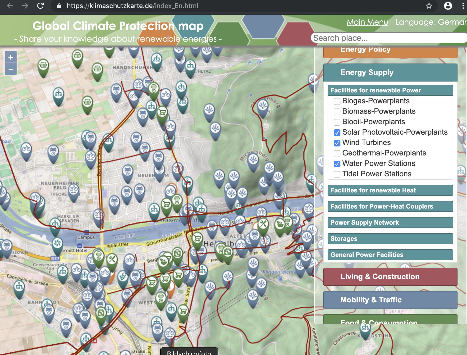
The OSM Global Climate Protection Map is based on user-contributed data from the free and open OpenStreetMap (OSM). It allows you both to share information about relevant geographic places as well as find out about topics related to climate protection and sustainability in your surrounding or area of interest. Some first relevant topics include map layers about for example renewable energy, different mobility forms as well as sustainable consumption and food etc. Click on one of the different categories to choose from and explore the related information layers on the map.
In the interactive online map, users worldwide can provide concrete references to facilities or offers that make it possible to make their own lifestyle climate-friendly – such as weekly markets with regional products, second-hand shops, car-sharing offers or facilities for the production of renewable energies in their area. Learn about how to contribute such (and more) information to OSM in the OSM Wiki
Better information is the first step for the right action. Also YOU can contribute to climate protection through a more sustainable lifestyle. The Climate Protection Map helps you to do this by showing where you can find e.g. healthy bio food or where to repair broken goods instead of throwing them to the waste and buying new stuff. Contribute your local knowledge about the five identified dimensions of climate protection to OpenStreetMap and raise the awareness of everyone on these important topics for society. Thanks to all OSM contributors for making this possible!
The five main dimensions provided by the map are at the moment the following. Each category can have several individual layers of information (see at the map):
– Energy Policy (e.g. Initatives and clubs)
– Energy Supply (e.g.Biogas-powerplants, gas storages, geothermal facilities etc.)
– Living and Construction (Proxy for house heating demand: Building Surface-Are to Volume Ratio, for Heidelberg only)
– Mobility and Traffic (e.g. Rent-a-bike-Stations, E-mobility charging stations, Car Sharing Places etc.)
– Food and Consumption (e.g. Organic Supermarkets, Farm Shops, Repair Shops or Second-Hand Shops)
Individual regions can be compared to one another, and a greater awareness of citizens’ climate protection and energy needs is created.
The Klimaschutzkarte.de has been realized by GIScience Heidelberg in cooperation with ifeu Heidelberg (Institute for Energy and Environment Heidelberg) and was funded by Ministerium für Wissenschaft, Forschung und Kunst Baden-Württemberg, Germany.
From citizens for citizens: Share your local knowledge about the relevant topics in OSM and inform yourself about possibilities for more sustainable living!