
In a new publication, we show how deep neural networks can be used in an end-to-end manner for the classification of 3D point clouds from airborne laser scan data. The research, based on the award-winning diploma thesis of Lukas Winiwarter at TU Wien, has now been published in “PFG – Photogrammetrie, Fernerkundung, Geoinformation“, the Journal of the German Society of Photogrammetry and Remote Sensing (DGPF).
Additionally, we were invited to provide a cover image for this issue, which you can see below:
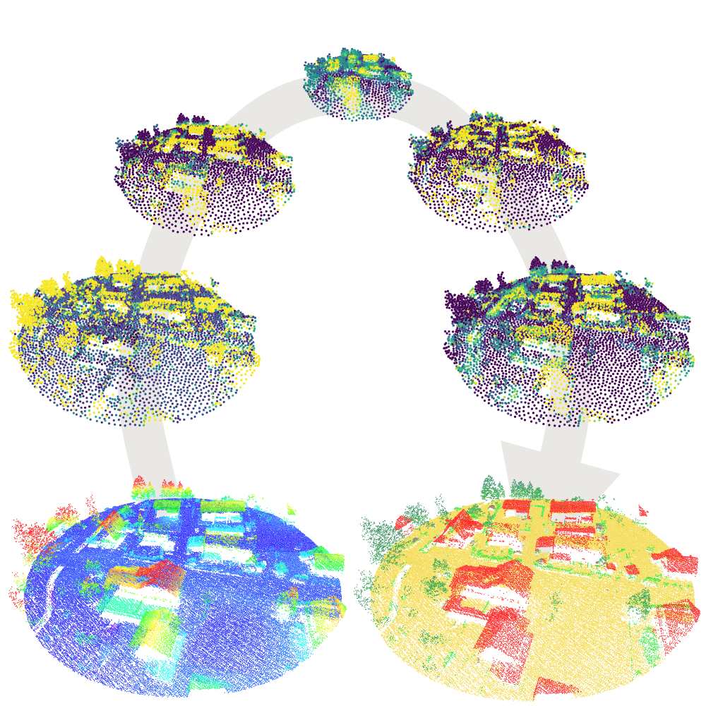
The method, titled ‘alsNet’, makes use of properties inherent to airborne laser scanning data, such as the spatial data distribution and per-point attributes stemming from the sensor. Incorporating this into a neural network for set abstraction, PointNet++ (Qi et al., 2017), allows the derivation of neighbourhood features (shown in the Figure) that are learned in the training process. This eliminates the need for expert feature crafting.
The code used in this research has been made available at GitHub: https://github.com/lwiniwar/alsnet
More details can be found in the Paper:
Winiwarter, L., Mandlburger, G., Schmohl, S., Pfeifer N. (2019): Classification of ALS Point Clouds Using End-to-End Deep Learning. PFG, 87: 75-90, DOI: 10.1007/s41064-019-00073-0.