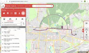
Since some time the City of Karlsruhe uses the API of Openrouteservice (ORS) by HeiGIT for routing of pedestrians, bicycles and cars in the new online city plan and the citizen GIS app for the general public, i.e. the citizens and visitors of Karlsruhe. You can use it here:
https://geoportal.karlsruhe.de/stadtplan
https://geoportal.karlsruhe.de/buergergis
The specific client developed by the Liegenschaftsamt, city of Karlsruhe is based on the ArcGIS for Javascript API and optimises as a widget for the ArcGIS Web AppBuilder by Esri. The public transportation functionality is based on the TRIAS interface.
This demonstrates that Openrouteservice can easily be integrated in several clients and apps. Openrouteservice uses the free and open data of OpenStreetMap (OSM) and provides a rich set of API functionality for the whole globe, as well as an ecosystem of different libraries and clients, e.g. for Javascript, Python, R, QGIS, Java etc.
The list of the free and open source ORS API features include, e.g. also
- routing with directions for pedestrian, wheelchair, car, different types of bicycle profiles and heavy vehicle profiles with many options
- vehicle fleed optimization (traveling salesman etc)
- isochrones for reachability applications
- time-distance matrices
- geocoding and reverse geocoding
- points of interest
- …
Please note that the quota for openrouteservice multi vehicle optimization has been increased to support logistics during the Corona crisis. You can also test the interactive documentation of the different API endpoints. Recent research at GIScience Heidelberg and HeiGIT related to routing deals e.g. with healthy and green routing, or quite routing, as well as applications in humanitarian aid (e.g. access to healthcare in Africa).


