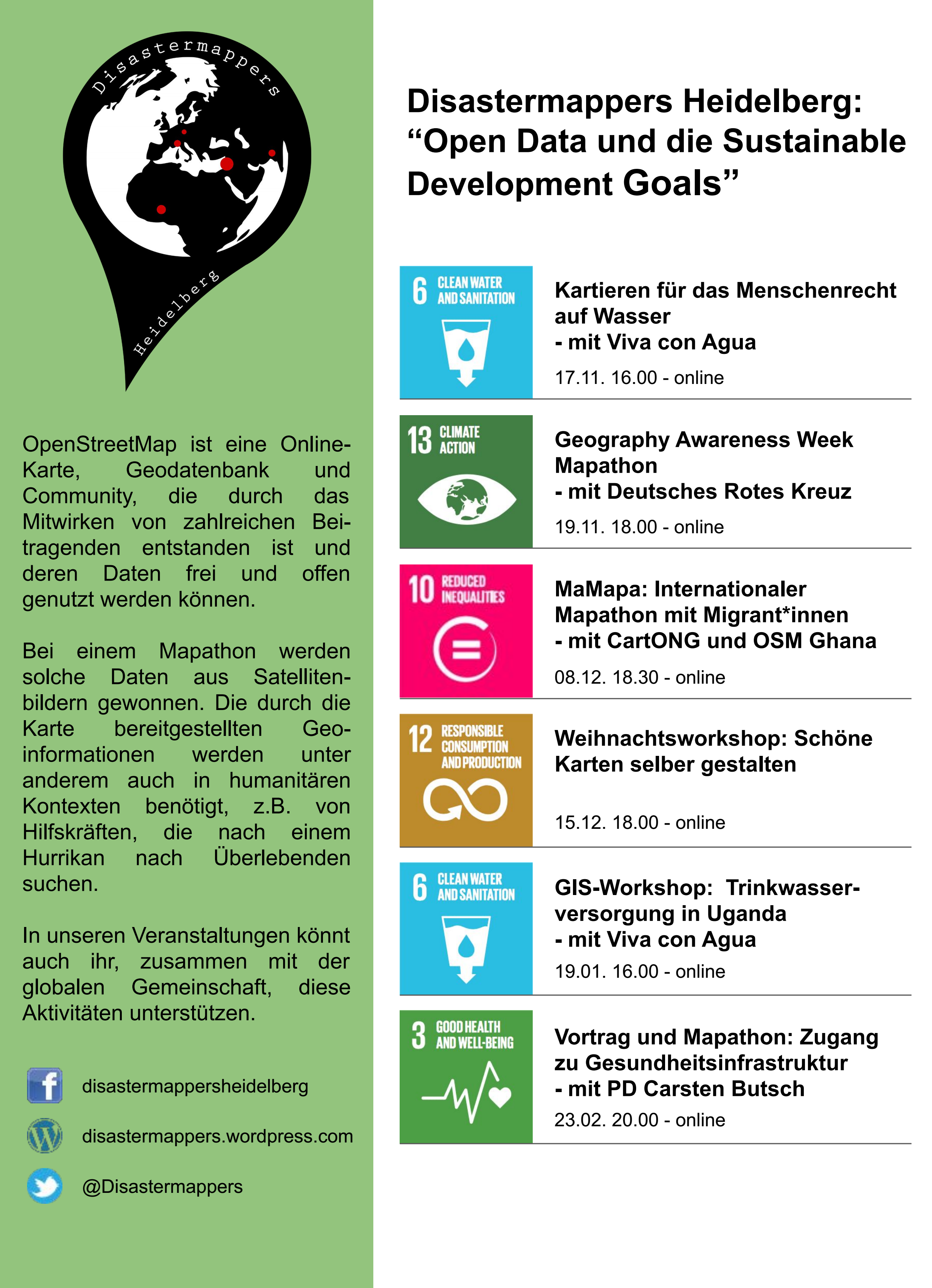
On December 8th at 6.30 pm the next international mapathon organized by the disastermappers heidelberg takes place! This time we map together with MAMAPA, an integration project for migrants and refugees from Mannheim, CartONG, LECLARA Larabanga and OSM Ghana.
We will map HOT-Tasks 8839 and 9928, the former including the city of Wa in northwestern Ghana, the latter in Accra.
You can join the event via https://audimax.heiconf.uni-heidelberg.de/mzt4-vfgk-hy4y-djfp
The motivation:
Up to now, not all map data is available everywhere in the world, which often limits the possibilities for disaster prevention and preparedness, needs assessments for relief organisations and many other purposes. So be part of the worldwide OSM mapping community! Everyone is welcome – no matter if you are an experienced mapper or a newcomer. A prepared tutorial provides a suitable introduction for beginners, so that no previous knowledge is required.
What you need:
Prepare a headset to be able to swap and a mouse which will make mapping easier. Unfortunately we can’t provide you with snacks and drinks at the moment – so remember to prepare something; then the event will be even more fun!
The partners for this mapathon:
The MAMAPA project is conceived both to aid humanitarian cartography and, at the same time, to support the integration of “new arrivers” (migrants, refugees) in the Rhein-Neckar metropolitan region. During the project mapathons, locals and recent arrivers build tandems at each workstation and collaborate on the mapping task. Ample opportunity is provided for contact and conversation in the few hours spent together. (For further information, please visit https://mamapa.org or mannheimermapathons)
CartONG is a NGO located in Chambéry, France, and provides cartographic and related expertise and services ( e.g. data management, mobile data collection) for humanitarian organizations worldwide. Major clients include Doctors without Borders and the UNHCR. When these organisations are in the field, CartONG works with them to provide maps as well as to generate and manage data essential for mission success. (For further information, please visit https://cartong.org; https://cartong.org/volunteering)
OSM Ghana, a non-profit organisation, is dedicated to completing the mapping of the country as well as providing training in the use of free and open source geographic tools for humanitarian and developmental goals. The group, active in the FOSS Community, has been involved in the recent past in numerous projects including Open Cities Accra, mapping with LECLARA (Larabanga, Ghana) for sustainable tourism development and participation in the organisation of an African Technical Exchange in Accra for the Secondary Cities project. (For further information, please visit https://osmghana.org )
LECLARA Larabanga is an organization of local activists in the town of Larabanga, in the Savannah Region of Ghana. They pursue a number of goals important for development in Larabanga, both cultural and educational. Since 2006, (together with the current Project Director of MAMAPA), much was accomplished for primary and secondary schooling (Project “LIEI”), with a particular emphasis on offering educational opportunities for young girls in the village.Located a few kilometers from Mole National Park and home to a Mosque and Koran dating from the 15th/16th centuries, Larabanga has exceptional touristic potential. Since 2016, to spur local development, LECLARA has been involved in building an infrastructure for sustainable tourism. As well, local youth have found opportunities as trained guides.Mapping is essential to this effort. With support from CartONG and OSM Ghana and as the recipient of a HOT Microgrant (2018-19) Larabanga and the surrounding area are now completely mapped. At the same time, workshops on OSM mapping techniques and mobile data collection have been held locally for members of LECLARA. While tourism there (as everywhere else) is currently “on hold”, up-to-date maps are as well an important tool for defending the health and safety of the population both during the current pandemic and into the future. (For further information, please visit https://visitlarabanga.org or LIEI (pre-2016) https://liei-ghana.org .)
Further upcoming events by disastermappers heidelberg.
- December 8th, 2020, MaMaPa: International Mapathon with Migrants and CartONG and OSM Ghana
- December 15th, 2020, Christmas Workshop
- January 19th, 2021, GIS Workshop with Viva Con Agua – Access to drinking water
- February 23rd, 2021, Talk and Mapathon – Access to Healthcare Infrastructure with PD Carsten Butsch