
When and where do changes occur in dynamic natural landscapes? A new method has been published that enables the automatic extraction of surface changes from entire time series of 3D point clouds. The developed method of spatiotemporal segmentation extracts changes regarding their surface change history, which makes it particularly useful for natural scenes that are subject to continual changes with smooth surface morphology. In the article, the method is used in a coastal monitoring application to extract accumulation and erosion forms on a sandy beach. The beach site was acquired by terrestrial laser scanning at hourly intervals over six months.
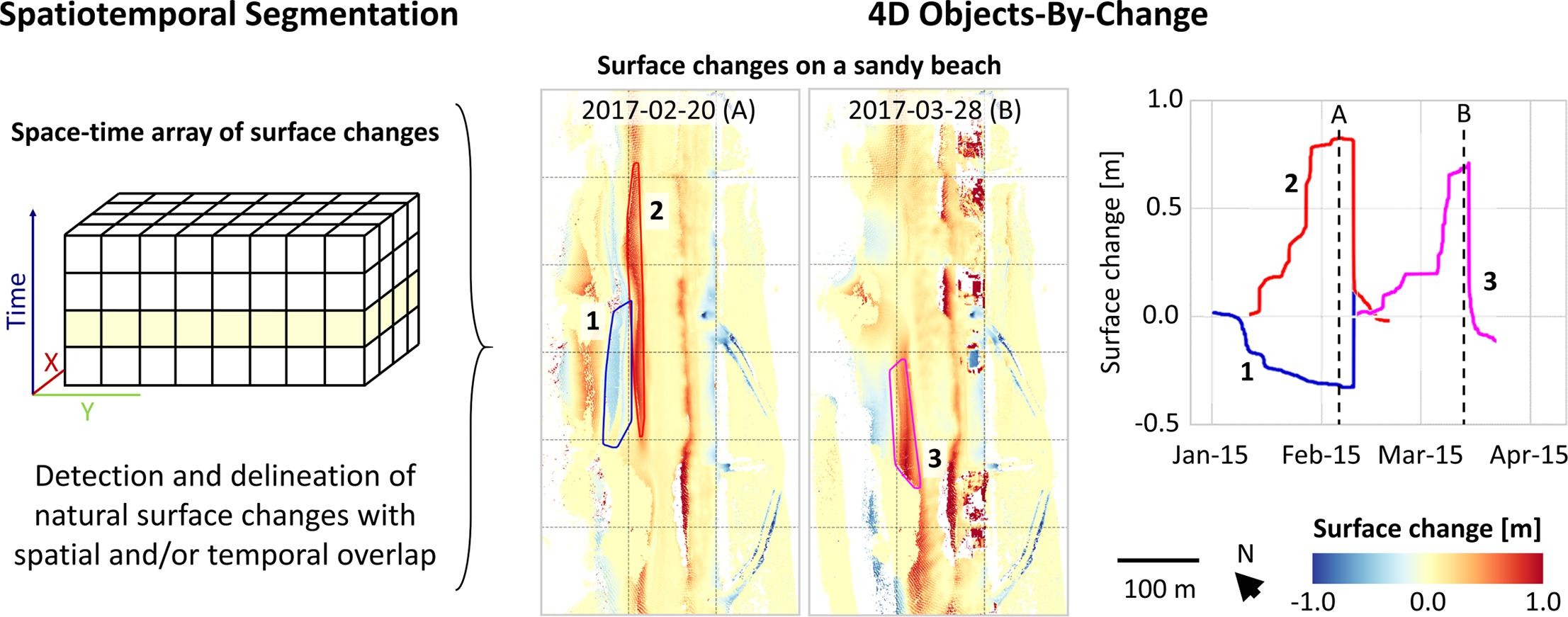
Fully automatic spatiotemporal segmentation of the 15 billion 3D points in 3,000 epochs yielded more than 2,000 so-called 4D objects-by-change representing temporary accumulation or erosion forms. The detected objects will provide the basis for detailed change analysis, for example of sediment transport on the beach linked to external drivers of wind, wave and anthropogenic forcing.
Anders, K., Winiwarter, L., Mara, H., Lindenbergh, R., Vos, S. E., Höfle B. (2021). Fully automatic spatiotemporal segmentation of 3D LiDAR time series for the extraction of natural surface changes. ISPRS Journal of Photogrammetry and Remote Sensing, 173, pp. 297-308. DOI: 10.1016/j.isprsjprs.2021.01.015.
Free article access until 30th March 2021 via this link: https://authors.elsevier.com/a/1cYWO3I9x1fKmO
To stay updated, follow us on ResearchGate!
The background of 4D change analysis within the Auto3Dscapes project is presented in this video: https://youtu.be/Fdwq-Cp0mFY
The research is carried out in cooperation with researchers from TU Delft in the frame of the CoastScan project. The PhD project Auto3Dscapes is supported by the Heidelberg Graduate School of Mathematical and Computational Methods for the Sciences (HGS MathComp).