• Home
  • About

GIScience News Blog

News of Heidelberg University’s GIScience Research Group.

Feed on
Posts
Comments
« Diskussionsrunde zum Thema «Humanitäre Kartographie» bei den Mannheimer einander.Aktionstagen 2021
Alexander Zipf selected as Marsilius Fellow 2021/2022 - Project with HIGH on Climate Change and Health »

Uncovering the dynamics of the inland dunes in Sandhausen using UAV-borne 3D data acquisition

Oct 13th, 2021 by Hannah Weiser

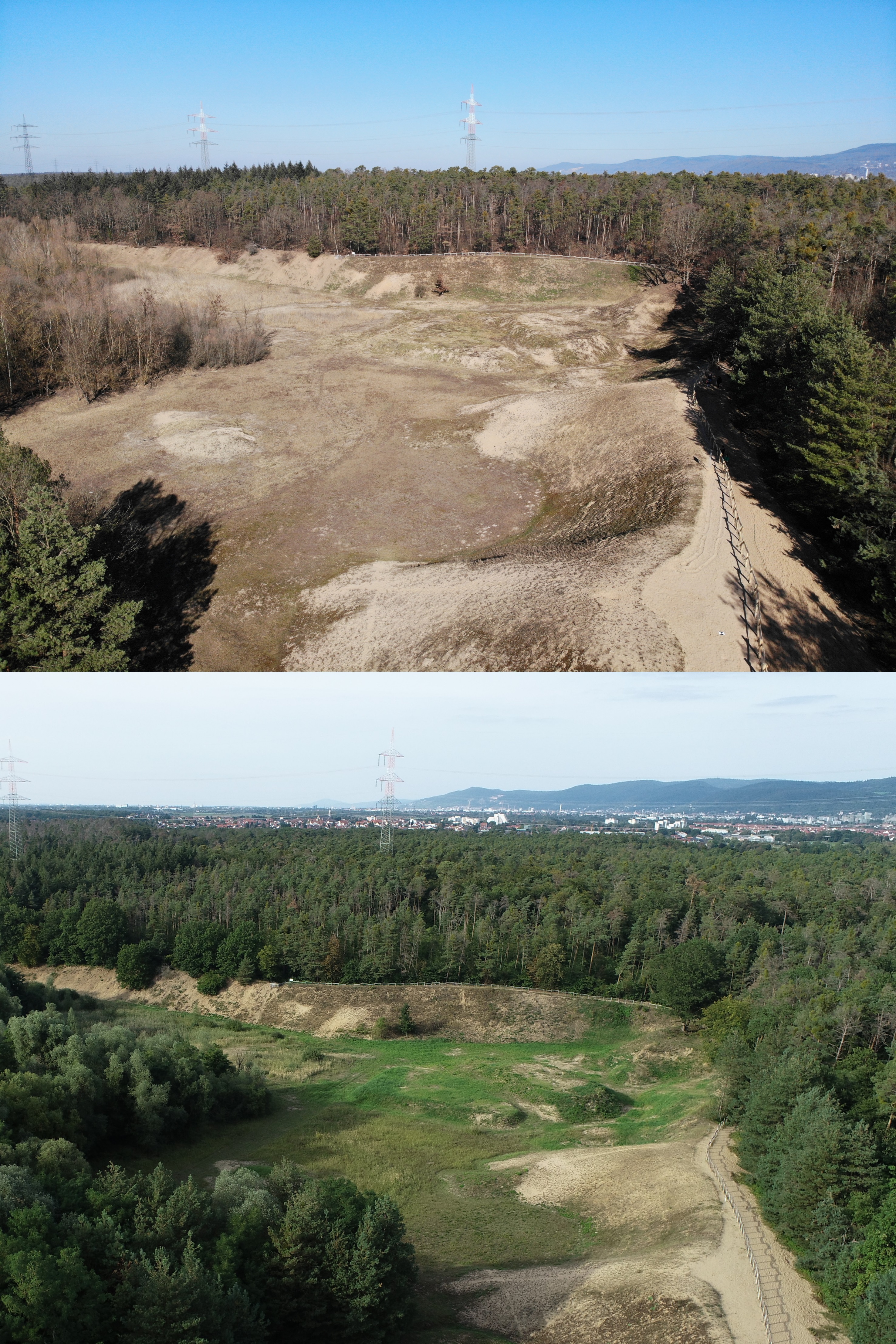
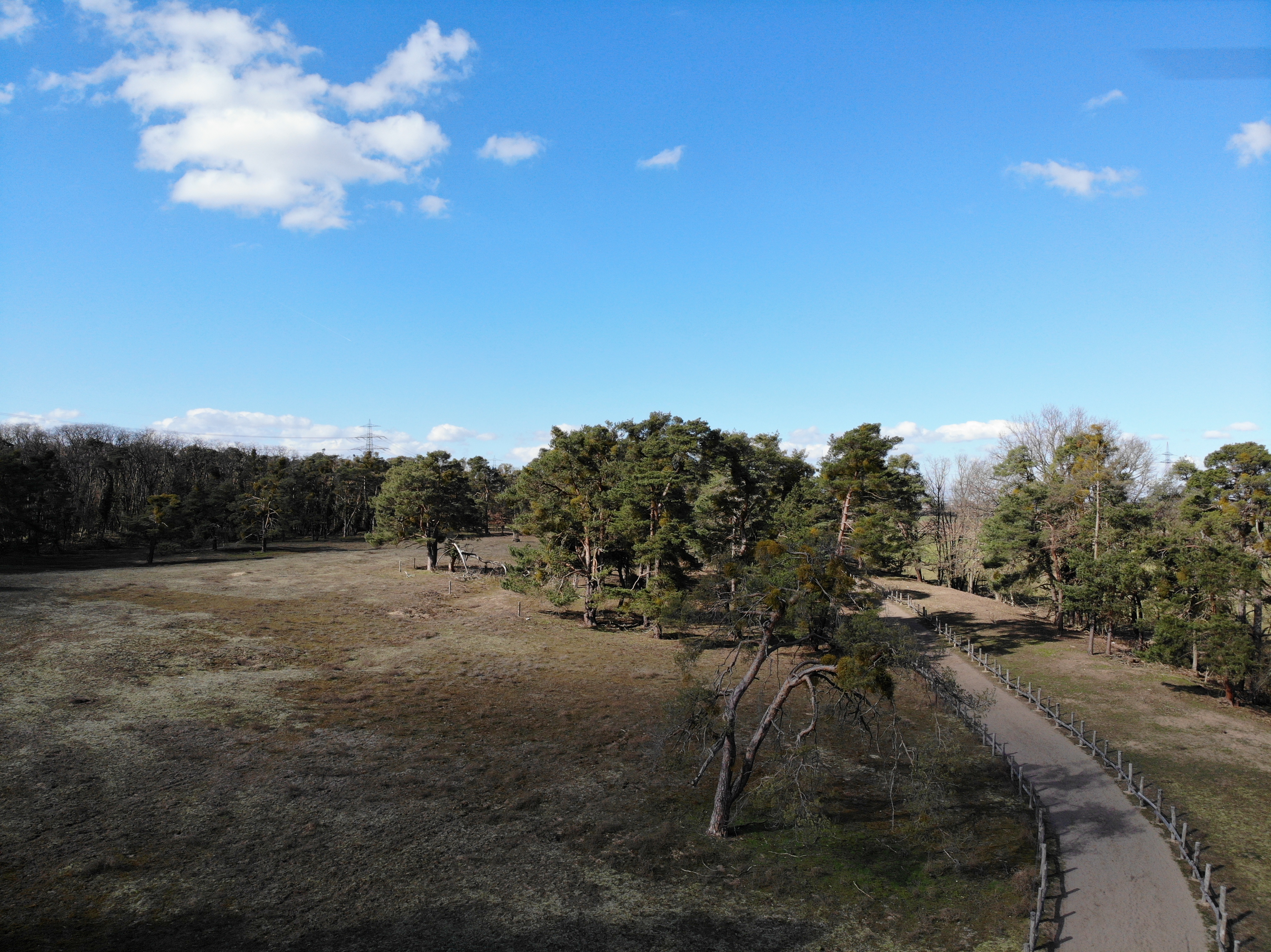
For the first time, the inland dunes in Sandhausen (Baden-Württemberg, Germany) have been captured by UAV-borne photogrammetry and laser scanning. The dunes are a precious habitat for many specialized plants and animals. They formed during the last ice age by sand drift from the Rhine valley. The large inland dunes, originally stretching from Karlsruhe to Mainz, have been wooded and only small areas have kept their initial dune character or have regained it. The sandy substrate and the aridity create grasslands with extreme conditions, which many rare and adapted plant and animal species thrive in (http://duene-sandhausen.de/). To preserve the valuable site conditions, the dune areas in Sandhausen are under protection. Habitats are maintained, e.g., by temporarily grazing sheep, goats, cows, or donkeys, which prevent ecological succession to forest.

The dunes have always been dynamic, both due to natural and anthropogenic influences. This is reflected in the land cover and geomorphology. By 3D data capturing of this unique habitat the 3DGeo research group aims at observing and analysing the current state of the dune areas and their development over the next years. Further acquisitions are planned in the future to uncover and document the dynamics of the areas. This can help understand the response of the vegetation to warming climate, the effects of grazing, or the influence of human activities.

Sandhausen Düne Pflege Schönau im Februar

The nature reserve "Pflege Schönau" in February.

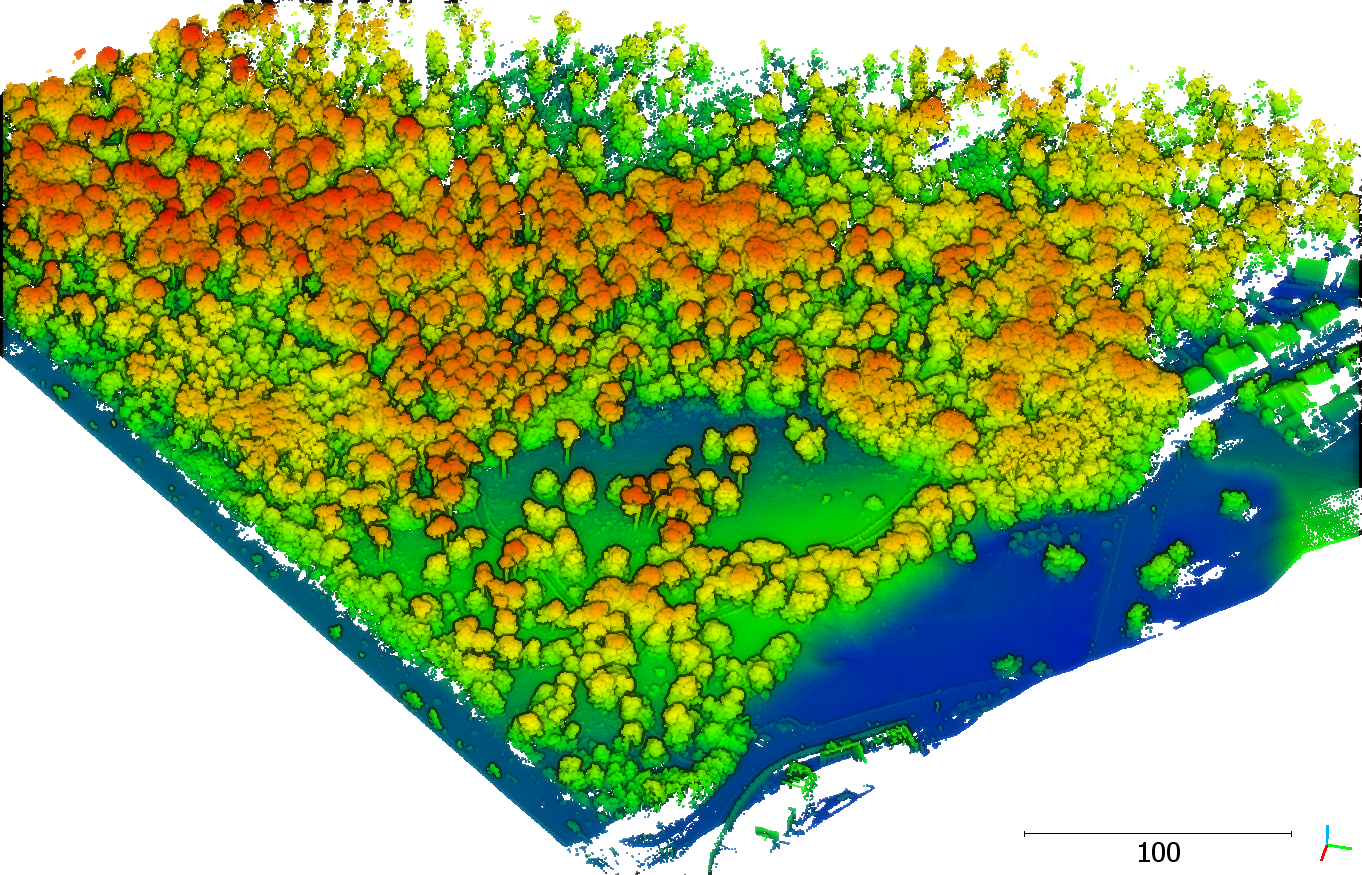
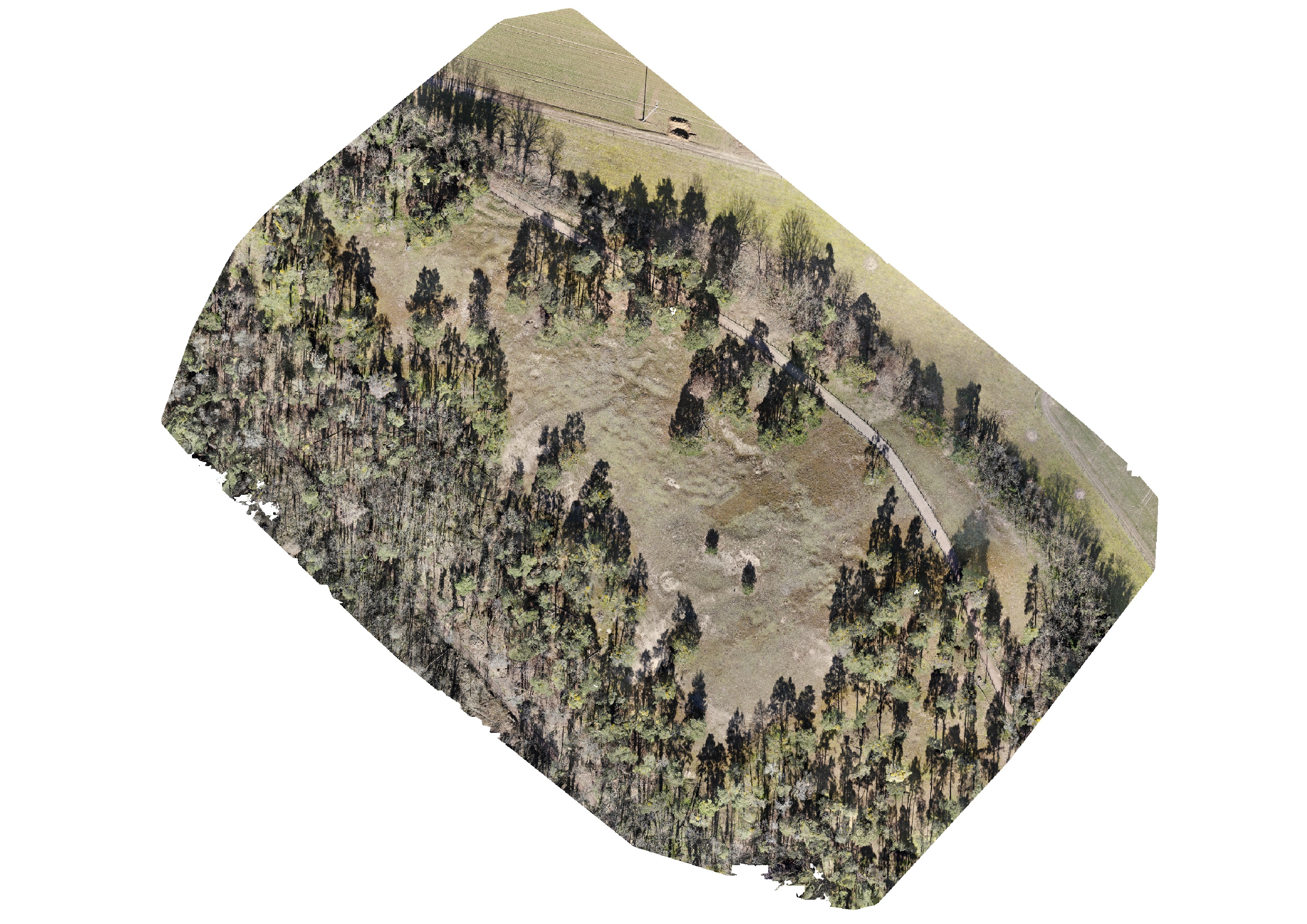
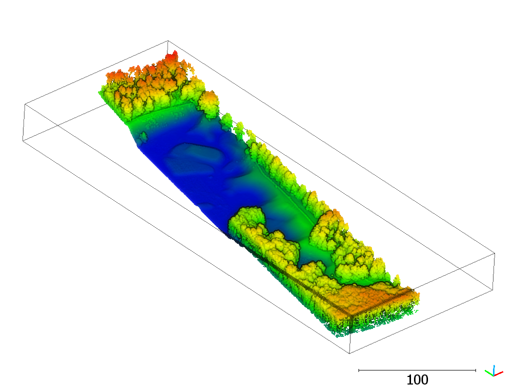
We acquired UAV-borne data of the inland dunes with an RGB camera, taking a series of pictures for photogrammetric reconstruction, and with a 3D laser scanner. Both methods, photogrammetry and laser scanning, can create 3D point clouds, from which we can derive further products, like digital terrain models and vegetation parameters. With the images, we can also derive orthophotos.

With a new multitemporal dataset, we aim to test and develop our methods for 3D change detection, e.g., Anders et al. 2021 and Winiwarter et al. 2021. The dataset can be used as input for HELIOS++, to simulate laser scanning over changing scenes (see also Weiser et al. 2021). This can help to understand which sensors, level of detail, and monitoring frequencies are needed to identify important change types.

Stay tuned: Once we completed all data collection and processing, we will make the dataset openly available for the general public.

Punktwolke der Pferdstrieb-Düne, eingefärbt nach Höhenwerten

Laser scanning point cloud of the nature reserve "Pferdstrieb Süd", colored by height.

Orthophoto of the nature reserve "Pflege Schönau".

Orthophoto of the nature reserve.

Ausschnitt einer Laserscanning-Punktwolke der Düne Zugmantel-Bandholz, eingefärbt nach Höhenwerten.

Section of a laser scanning point cloud of the nature reserve "Zugmantel-Bandholz", colored by height.

Luftaufnahme des Gebiets Zugmantel-Bandholz im Februar (oben) und September (unten).

Aerial view of the nature reserve "Zugmantel-Bandholz" in February (top) and September (bottom).

Tags: conservation, dunes, ecology, field work, Lidar, Sandhausen, UAV, UAV-borne laser scanning, UAV-borne LiDAR, UAV-borne photogrammetry

Posted in 3D, Digital Earth, Lidar Group, Research, Uncategorized

Comments are closed.

  • About

    GIScience News Blog
    News of Heidelberg University’s GIScience Research Group.
    There are 1,636 Posts and 0 Comments so far.

  • Meta

    • Log in
    • Entries RSS
    • Comments RSS
    • WordPress.org
  • Recent Posts

    • Leveraging OpenStreetMap and Multimodal Remote Sensing Data with Joint Deep Learning for Wastewater Treatment Plants Detection
    • HGG Vortrag: Heute: Erneuerbare Energien als Entwicklungschance? Deutschland und Kenia im Vergleich. Prof. Klage, 17.05., 19:15 Uhr
    • New “Robert and Christine Danziger PhD Scholarships“ 2022 in Geoinformatics at GIScience Heidelberg University for PhD students from Africa - DL 15.July
    • HGG Vortrag: “Großmacht Russland? Geographien der Transformation im Bereich der ehemaligen Sowjetunion” , Dienstag 10.05.22, 10ct
    • ohsome Region of the month - Back on trail
  • Tags

    3D 3DGEO Big Spatial Data CAP4Access Citizen Science Climate Change crisis mapping Crowdsourcing data quality deep learning disaster DisasterMapping GeoNet.MRN GIScience heigit HOT humanitarian humanitarian mapping Humanitarian OpenStreetMap team intrinsic quality analysis landuse laser scanning Lidar machine-learning Mapathon MapSwipe Missing Maps MissingMaps ohsome ohsome example Open data openrouteservice OpenStreetMap OSM OSM History Analytics Public Health Quality quality analysis remote sensing routing social media spatial analysis Teaching VGI Workshop
  • Archives

    • May 2022
    • April 2022
    • March 2022
    • February 2022
    • January 2022
    • December 2021
    • November 2021
    • October 2021
    • September 2021
    • August 2021
    • July 2021
    • June 2021
    • May 2021
    • April 2021
    • March 2021
    • February 2021
    • January 2021
    • December 2020
    • November 2020
    • October 2020
    • September 2020
    • August 2020
    • July 2020
    • June 2020
    • May 2020
    • April 2020
    • March 2020
    • February 2020
    • January 2020
    • December 2019
    • November 2019
    • October 2019
    • September 2019
    • August 2019
    • July 2019
    • June 2019
    • May 2019
    • April 2019
    • March 2019
    • February 2019
    • January 2019
    • December 2018
    • November 2018
    • October 2018
    • September 2018
    • August 2018
    • July 2018
    • June 2018
    • May 2018
    • April 2018
    • March 2018
    • February 2018
    • January 2018
    • December 2017
    • November 2017
    • October 2017
    • September 2017
    • August 2017
    • July 2017
    • June 2017
    • May 2017
    • April 2017
    • March 2017
    • February 2017
    • January 2017
    • December 2016
    • November 2016
    • October 2016
    • September 2016
    • August 2016
    • July 2016
    • June 2016
    • May 2016
    • April 2016
    • March 2016
    • February 2016
    • January 2016
    • December 2015
    • November 2015
    • October 2015
    • September 2015
    • August 2015
    • July 2015
    • June 2015
    • May 2015
    • April 2015
    • March 2015
    • February 2015
    • January 2015
    • December 2014
    • November 2014
    • October 2014
    • September 2014
    • August 2014
    • July 2014
    • June 2014
    • May 2014
    • April 2014
    • March 2014
    • February 2014
    • January 2014
    • December 2013
    • November 2013
    • October 2013
    • September 2013
    • August 2013
    • July 2013
    • June 2013
    • May 2013
    • April 2013
  •  

    October 2021
    M T W T F S S
    « Sep   Nov »
     123
    45678910
    11121314151617
    18192021222324
    25262728293031
  • Recent Comments

    GIScience News Blog CC by-nc-sa Some Rights Reserved.

    Free WordPress Themes | Fresh WordPress Themes