• Home
  • About

GIScience News Blog

News of Heidelberg University’s GIScience Research Group.

Feed on
Posts
Comments
« Recent feature additions to Ohsome Quality analysT
Audiobeitrag: Das Heidelberg Institute for Geoinformation Technology (HeiGIT) im Campus Radio »

3DGeo contributions to ISPRS Congress 2022 now online

Jun 17th, 2022 by Vivien Zahs

From 5 June - 11 June 2022 the ISPRS Congress took place in Nice, France. The 3DGeo research group had three paper contributions which can now be found online:

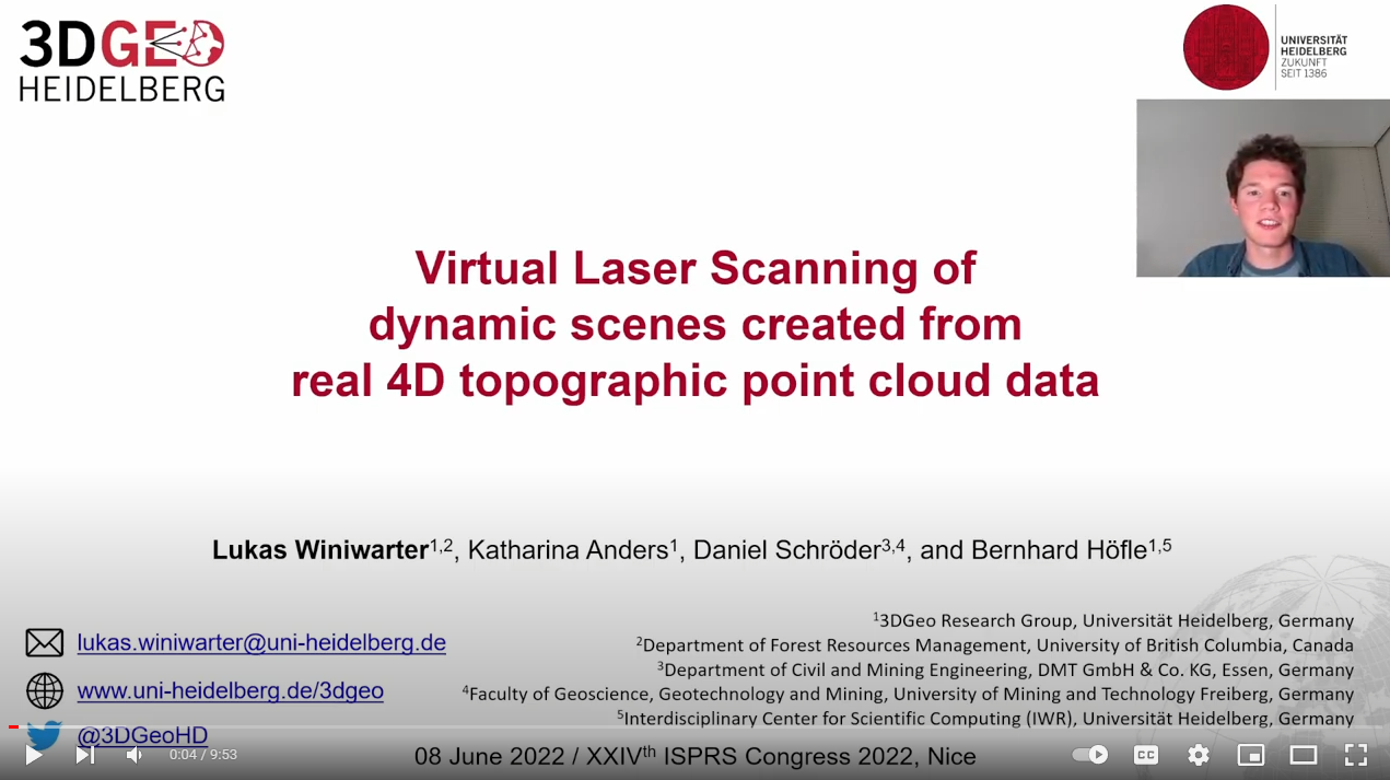
(1) Virtual Laser Scanning of Dynamic Scenes Created From Real 4D Topographic Point Cloud Data.

Find all details in the video (link) and paper and check the related project website.

Winiwarter, L., Anders, K., Schröder, D. & Höfle, B. (2022): Virtual Laser Scanning of Dynamic Scenes Created From Real 4D Topographic Point Cloud Data. ISPRS Annals of the Photogrammetry, Remote Sensing and Spatial Information Sciences. Vol. V-2-2022, pp. 79-86.


(2) Integration of Kalman Filtering of Near-Continuous Surface Change Time Series into the Extraction of 4D Objects-by-Change

Find all details in the related paper and see the 4D Objects-By-Change project website.

Anders, K., Winiwarter, L., Schröder, D. & Höfle, B. (2022): Integration of Kalman Filtering of Near-Continuous Surface Change Time Series into the Extraction of 4D Objects-by-Change. International Archives of the Photogrammetry, Remote Sensing and Spatial Information Sciences. Vol. XLIII-B2-2022, pp. 973-980.
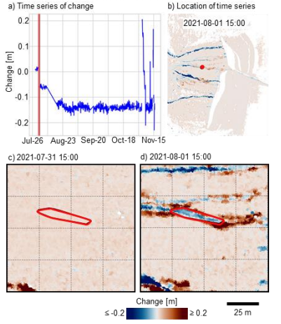
4D object-by-change (4D-OBC) extracted at an example location of detected changes. a) Time series of changes with 4D-OBC timespan marked by red vertical lines. The location of the time series in the scene is marked in (b). Close-up maps show bitemporal changes at (c) the detected start and (d) the detected end epoch with the spatial extent of the 4D-OBC (red polygon).

4D object-by-change (4D-OBC) extracted at an example location of detected changes. a) Time series of changes with 4D-OBC timespan marked by red vertical lines. The location of the time series in the scene is marked in (b). Close-up maps show bitemporal changes at (c) the detected start and (d) the detected end epoch with the spatial extent of the 4D-OBC (red polygon).

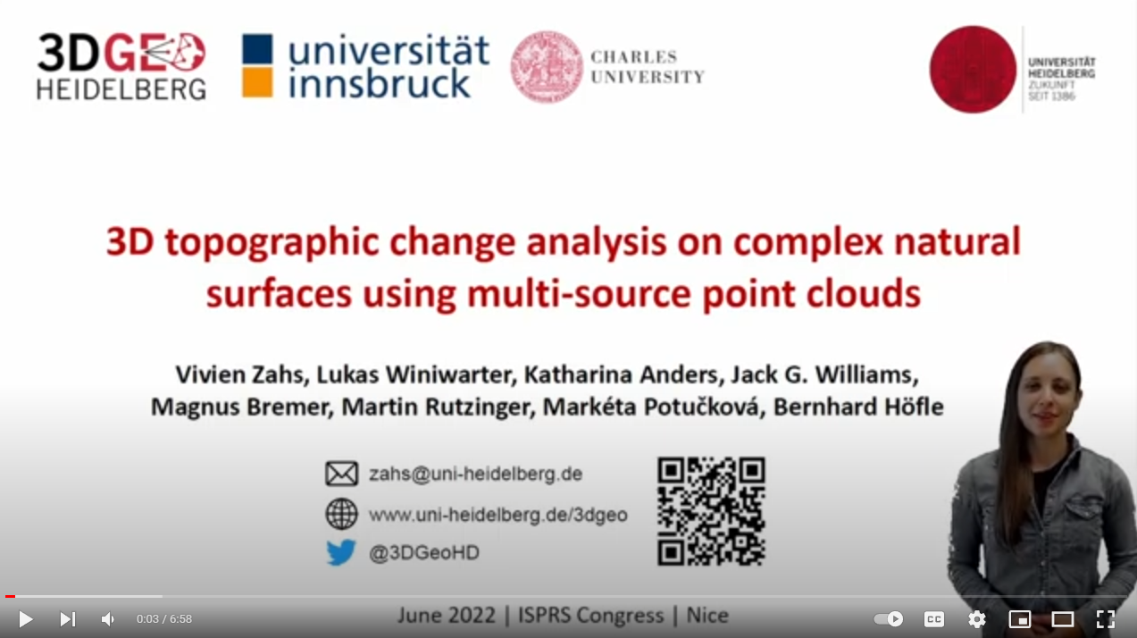
(3) Evaluation of UAV-borne photogrammetry and UAV-borne laser scanning for 3D topographic change analysis of an active rock glacier.

Find all details in the video (link) and paper and check the related project websites of AHK-4D and Multi-Directional 3D topographic Change.

Zahs, V., Winiwarter, L., Anders, K., Bremer, M. Rutzinger, M. Potůčková, M., Höfle, B. (2022): Evaluation of UAV-borne photogrammetry and UAV-borne laser scanning for 3D topographic change analysis of an active rock glacier. International Archives of the Photogrammetry, Remote Sensing and Spatial Information Sciences. Vol. XLIII-B2-2022, pp. 1109-1116. DOI: 10.5194/isprs-archives-XLIII-B2-2022-1109-2022.

Tags: 3DGEO, 4D, 4D Objects-By-Change, AHK-4D, Conference, HELIOS, ISPRS Congress, mulit-directional change, Paper

Posted in 3D, Digital Earth, Events, Lidar Group, Publications, Research

Comments are closed.

  • About

    GIScience News Blog
    News of Heidelberg University’s GIScience Research Group.
    There are 1,674 Posts and 0 Comments so far.

  • Meta

    • Log in
    • Entries RSS
    • Comments RSS
    • WordPress.org
  • Recent Posts

    • New paper on the automatic characterization of surface activities from 4D point clouds
    • OSHDB Version 1.0 Has Arrived
    • Job Opening for Postdoc / Senior Researcher on OpenStreetMap Road Quality Analysis
    • Geography Awareness Week 14.-19.11.2022
    • Open Data: Multi-platform point clouds and orthophotos of the inland dune in Sandhausen
  • Tags

    3D 3DGEO Big Spatial Data CAP4Access Citizen Science Conference crisis mapping Crowdsourcing data quality deep learning disaster DisasterMapping GeoNet.MRN GIScience heigit HOT humanitarian humanitarian mapping Humanitarian OpenStreetMap team intrinsic quality analysis landuse laser scanning Lidar machine-learning Mapathon MapSwipe MissingMaps Missing Maps ohsome ohsome example Open data openrouteservice OpenStreetMap OSM OSM History Analytics Public Health Quality quality analysis remote sensing routing social media spatial analysis Teaching VGI Workshop
  • Archives

    • December 2022
    • November 2022
    • October 2022
    • September 2022
    • August 2022
    • July 2022
    • June 2022
    • May 2022
    • April 2022
    • March 2022
    • February 2022
    • January 2022
    • December 2021
    • November 2021
    • October 2021
    • September 2021
    • August 2021
    • July 2021
    • June 2021
    • May 2021
    • April 2021
    • March 2021
    • February 2021
    • January 2021
    • December 2020
    • November 2020
    • October 2020
    • September 2020
    • August 2020
    • July 2020
    • June 2020
    • May 2020
    • April 2020
    • March 2020
    • February 2020
    • January 2020
    • December 2019
    • November 2019
    • October 2019
    • September 2019
    • August 2019
    • July 2019
    • June 2019
    • May 2019
    • April 2019
    • March 2019
    • February 2019
    • January 2019
    • December 2018
    • November 2018
    • October 2018
    • September 2018
    • August 2018
    • July 2018
    • June 2018
    • May 2018
    • April 2018
    • March 2018
    • February 2018
    • January 2018
    • December 2017
    • November 2017
    • October 2017
    • September 2017
    • August 2017
    • July 2017
    • June 2017
    • May 2017
    • April 2017
    • March 2017
    • February 2017
    • January 2017
    • December 2016
    • November 2016
    • October 2016
    • September 2016
    • August 2016
    • July 2016
    • June 2016
    • May 2016
    • April 2016
    • March 2016
    • February 2016
    • January 2016
    • December 2015
    • November 2015
    • October 2015
    • September 2015
    • August 2015
    • July 2015
    • June 2015
    • May 2015
    • April 2015
    • March 2015
    • February 2015
    • January 2015
    • December 2014
    • November 2014
    • October 2014
    • September 2014
    • August 2014
    • July 2014
    • June 2014
    • May 2014
    • April 2014
    • March 2014
    • February 2014
    • January 2014
    • December 2013
    • November 2013
    • October 2013
    • September 2013
    • August 2013
    • July 2013
    • June 2013
    • May 2013
    • April 2013
  •  

    June 2022
    M T W T F S S
    « May   Jul »
     12345
    6789101112
    13141516171819
    20212223242526
    27282930  
  • Recent Comments

    GIScience News Blog CC by-nc-sa Some Rights Reserved.

    Free WordPress Themes | Fresh WordPress Themes