
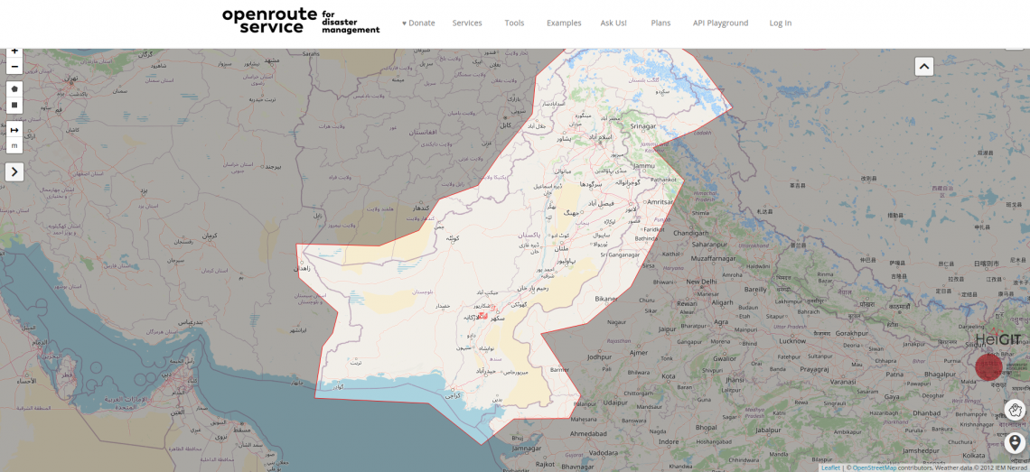
Over the past weeks, monsoon flooding in Pakistan has left over 1,000 dead and millions without homes. As reports and photos of skyrocketing food prices, residents wading through shoulder-deep water, and satellite images of flooded rivers highlight the magnitude of this catastrophe, HeiGIT has created an activation of the Disaster openrouteservice for that region. Currently, data is being updated every ten minutes to reflect the continued efforts of editing OpenStreetMap to reflect the dynamic situation and affected infrastructure.
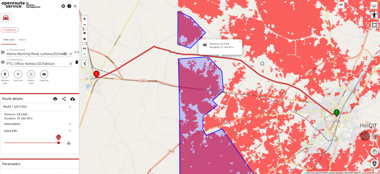
In addition, the flood extents identified from the Copernicus Emergency Management Service, Activation EMS629 are shown as an overlay on the base map. With these resources, users can avoid those areas by calculating routes that avoid flooded areas. To do so, draw a polygon around flood zones and the route will be automatically recalculated.
Previously, this service has been activated for events like Cyclone Idai, a category 4 tropical cyclone that caused over 1,300 fatalities and ranks as the deadliest tropical cyclone recorded in the South-West Indian Ocean. Idai began a humanitarian crisis in Mozambique and other parts of Southeast Africa. Mapping efforts for this project are supported by thousands of mappers contributing geodata to the global OpenStreetMap (OSM) community.
HeiGIT continues to develop tools to provide geodata solutions to real-time humanitarian disasters. Other projects related to aid and disaster response can be found here.