
Category: Events
-
End of Semester Mapathon
At the end of the semester will be another Mapathon! When: Monday, 31.07.2023, at 6 p.m. Where: Mathematikon, INF 205, 5th floor, conference room After a short introduction by Dr. Nil Fulman on “Street view imagery in GIScience: trends and challenges” the street quality of freely available images will be assessed. For this purpose, the…
-

Advancing Geospatial Techniques for Vector-Borne Disease Research: Insights from GIScience-CSIAD Collaboration – a conference recap
Recently, Hanse-Wirtschaftskolleg hosted its meeting which brought together experts from GIScience and CSIAD lab, along with renowned researchers from universities in Germany, Thailand, and Ghana, serving as a platform for interdisciplinary collaboration on vector-borne diseases. This event brought together esteemed researchers to share their expertise and insights into combating mosquito-borne illnesses. As an invited speaker,…
-
13th International Symposium on Digital Earth
From 11th until 14th July 2023 the 13th International Symposium on Digital Earth took place at Athens Greece Harokopio University. As a member of the International Symposium on Digital Earth (ISDE) Prof. Dr. Alexander Zipf was invited to deliver a speech at one of the ISDE sessions. ISDE is an international organization principally promoting academic…
-
Unleashing the Power of AI-Assisted Mapping in OpenStreetMap? – a webinar with HOT and Masaryk University
The ever-increasing volume and speed of corporate or machine learning-assisted mapping present unique challenges for individual volunteer mappers, particularly in terms of monitoring and validation. While the global impact and evolution of AI-assisted mapping in OpenStreetMap (OSM) remain largely unknown, there is a need to engage with mappers to understand their perspectives on this emerging…
-
Looking back at FOSS4G Conference 2023
Figure 1: FOSS4G 2023, QGIS daily openings This years FOSS4G conference took place from 26 June – 2 July 2023 in beautiful Prizren, Kosovo. Since 2006 FOSS4G, the largest global gathering for geospatial software, is organized by the Open Source Geospatial Foundation (OSGeo). This year workshops, presentations, discussions, cooperation and developing of geospatial tools and softwares…
-
Workshop on Intelligent Systems for Vector-Borne Disease at HWK
Heidelberg as a GeoHealth Hub: GIScience team member Steffen Knoblauch was invited by the Hanse-Wirtschaftskolleg to an event of the working group for Intelligent Systems for Vector-Borne Disease. Various sessions will be held, amongst others the session about Mosquito Monitoring first thing tomorrow. At 11 am Steffen will talk about “Key drivers for inner-urban dengue occurrence” during the Mosquito Monitoring session. He will elaborate…
-
Mosquito App Alert
Prof. Dr. Alexander Zipf and Charlie Hatfield from HeiGIT contribute with their expertise on participatory science to an interdisciplinary case study by IDAlert on the monitoring of invasive mosquito populations in Heidelberg and the Rhine-Neckar-Region. One part of the case study is the Mosquito Alert App that recently has been launched in Germany and draws…
-
Final meeting of the E-TRAINEE project
Last week, the 3DGeo research group hosted the final meeting of the E-TRAINEE project, finally and for the first time in presence. For almost three years now, we have been developing a research-oriented open-source e-learning course – soon to be published! The course on “Time Series Analysis in Remote Sensing for Understanding Human-Environment Interactions” teaches…
-
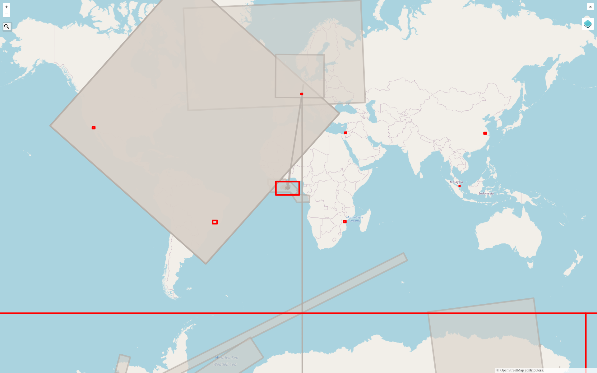
2022 #30DayMapChallenge Round-Up Part 2: Deleted Maps
Featured photo: The deleted map displays all deleted elements within the analyzed areas (red). Gray rectangles represent deleted buildings. This past November, our teams at HeiGIT and GIScience participated in Topi Tjukanov’s Twitter event #30DayMapChallenge, where mappers display their creativity and ingenuity with a set of 30 daily prompts ranging from colors to specific datasets…
-
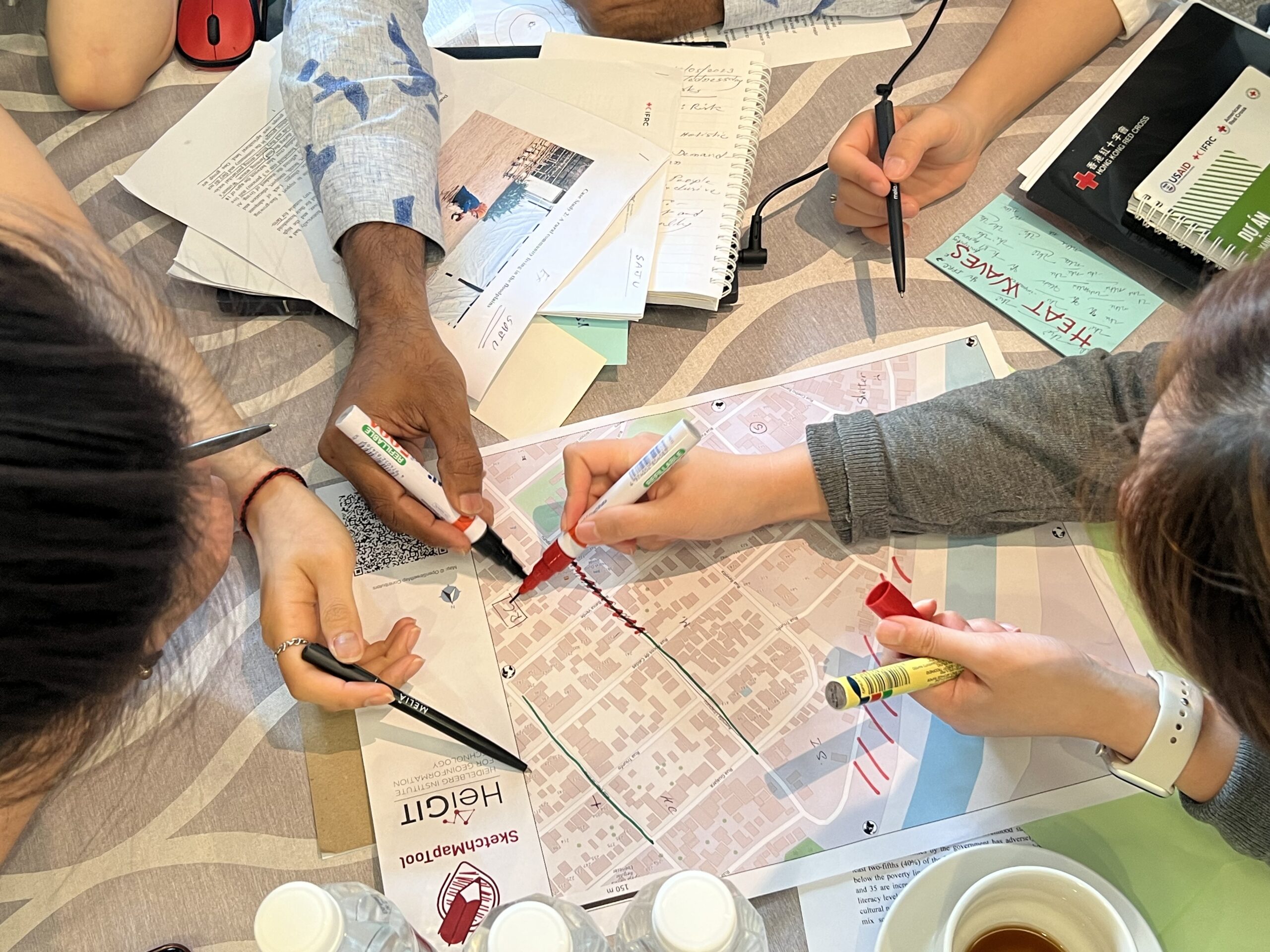
Training on digitalization of participatory mapping in Kuala Lumpur
Featured Image: Training participants simulating a participatory mapping on the ground with the SketchMapTool. Last week, HeiGIT team member Anne Schauß held a workshop session in Kuala Lumpur, Malaysia, during a training of the International Federation of Red Cross and Red Crescent Societies (IFRC). The international training focused on community resilience and how to assess…
-
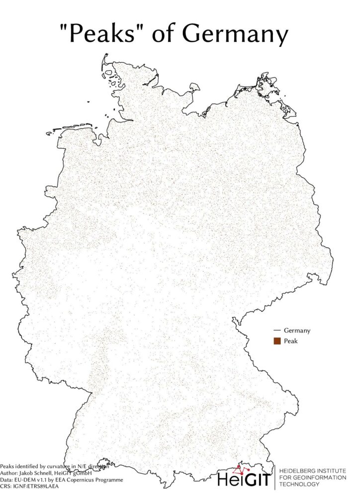
#30DayMapChallenge Round-Up Part 1: Germany Three Ways
Featured Image: The peaks of Germany identified by curvature in N/E direction, Jakob Schnell’s contribution for Day 7 (Raster) of the #30DayMapChallenge. This past November, our teams at HeiGIT and GIScience participated in Topi Tjukanov’s Twitter event #30DayMapChallenge, where mappers display their creativity and ingenuity with a set of 30 daily prompts ranging from colors to…
-
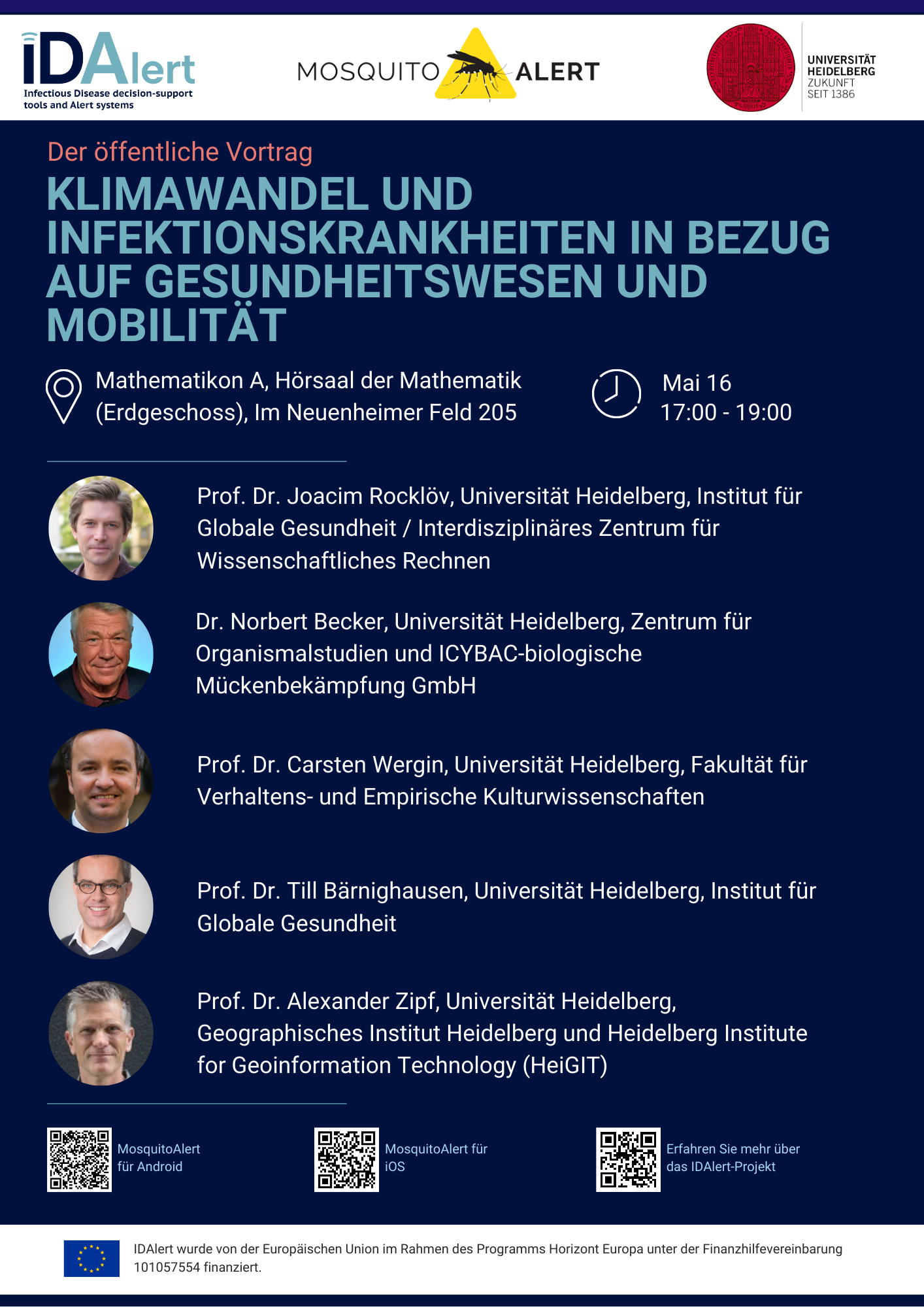
Öffentlicher Vortrag am 16. Mai: Klimawandel, Mobilität und das steigende Risiko von Infektionskrankheiten in Deutschland
Am Dienstag, den 16. Mai, werden die Besuchenden des öffentlichen Vortrags “Klimawandel und Infektionskrankheiten in Bezug auf Gesundheitswesen und Mobilität” Einblicke von fünf Experten erhalten, die derzeit Pionierarbeit bei der Erforschung einer der größten Bedrohungen für die öffentliche Gesundheit in Deutschland leisten. Die Veranstaltung findet in deutscher und englischer Sprache im Mathematik-Hörsaal im Erdgeschoss des…