
Category: Software
-

VirtuaLearn3D: New Preprint
We have published a preprint of our recent work in the VirtuaLearn3D project! Deep learning with simulated laser scanning data for 3D point cloud classification Esmorís, A.M., Weiser, H., Winiwarter, L., Cabaleiro, J.C. & Höfle, B. (2024) Laser scanning is an active remote sensing technique to acquire state-of-the-art spatial measurements in the form of 3D…
-
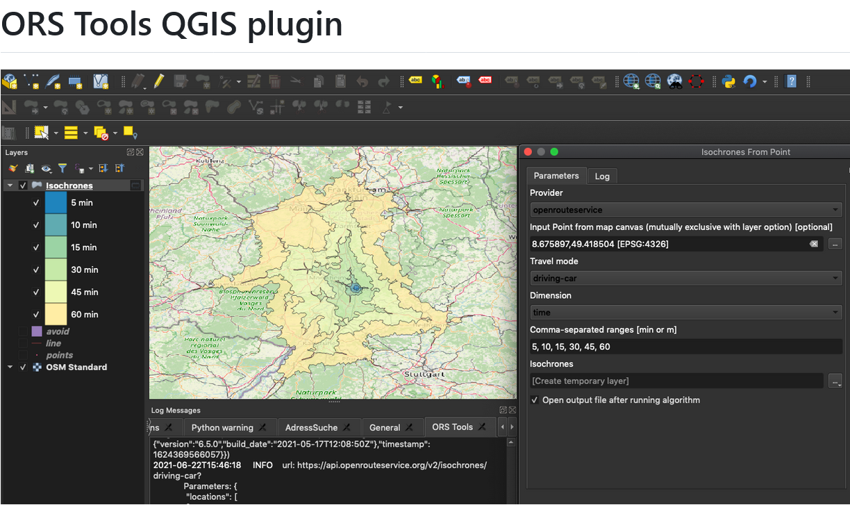
ORS Tools QGIS Plugin Release v1.7.0
Just in time for the new year, the openrouteservice team proudly announces the release of v1.7.0 of the ORS Tools QGIS plugin! Quite a lot has happened. First, the GUI was reworked: Next, there are a few other things that happened: Check out the changelog if you’re interested in all the in-depth details. Feedback and…
-
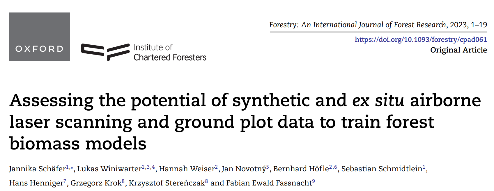
New paper on the potential of simulated laser scanning and field data to train forest biomass models
In great collaboration with colleagues from Karlsruhe (DE), Vienna (AT), Brno (CZ), Leipzig (DE), Raszyn (PL), and Berlin (DE), we published a paper investigating approaches to improve LiDAR-based biomass models when only limited sample plots with field data are available. The main work was carried out by PhD student Jannika Schäfer (IFGG, Karlsruhe Institute of…
-

DFG Software Grant
Successful proposal: Fostering a community-driven and sustainable HELIOS++ scientific software The 3DGeo Group and the Scientific Software Center (SSC) of Heidelberg University have been successful with their proposal in the DFG call “Research Software – Quality assured and re-usable”, together with two other project proposals at Heidelberg University (see press release). The main objective of…
-

🦇 Halloween release of HELIOS++, v1.3.0
We proudly present our Halloween release of HELIOS++, Version 1.3.0: https://github.com/3dgeo-heidelberg/helios/releases What’s new in this release? HELIOS++ now supports LiDAR simulation of dynamic scenes. We can now simulate laser scanning of scenes that change during the simulation. This is done by introducing rigid motions, which are defined with XML syntax in the scene XML file.…
-
Kick-off: AImon5.0 – Real-time monitoring of gravitational mass movements for critical infrastructure risk management with AI-assisted 3D metrology
In September 2023, our new research project AImon5.0 has been kicked-off. In this project the open-source frameworks HELIOS++ and py4dgeo of the 3DGeo research group will be combined to enhance current approaches for operational risk monitoring. AImon5.0 is an interdisciplinary collaboration project of the 3DGeo research group with DMT GmbH & Co. KG (project leader),…
-
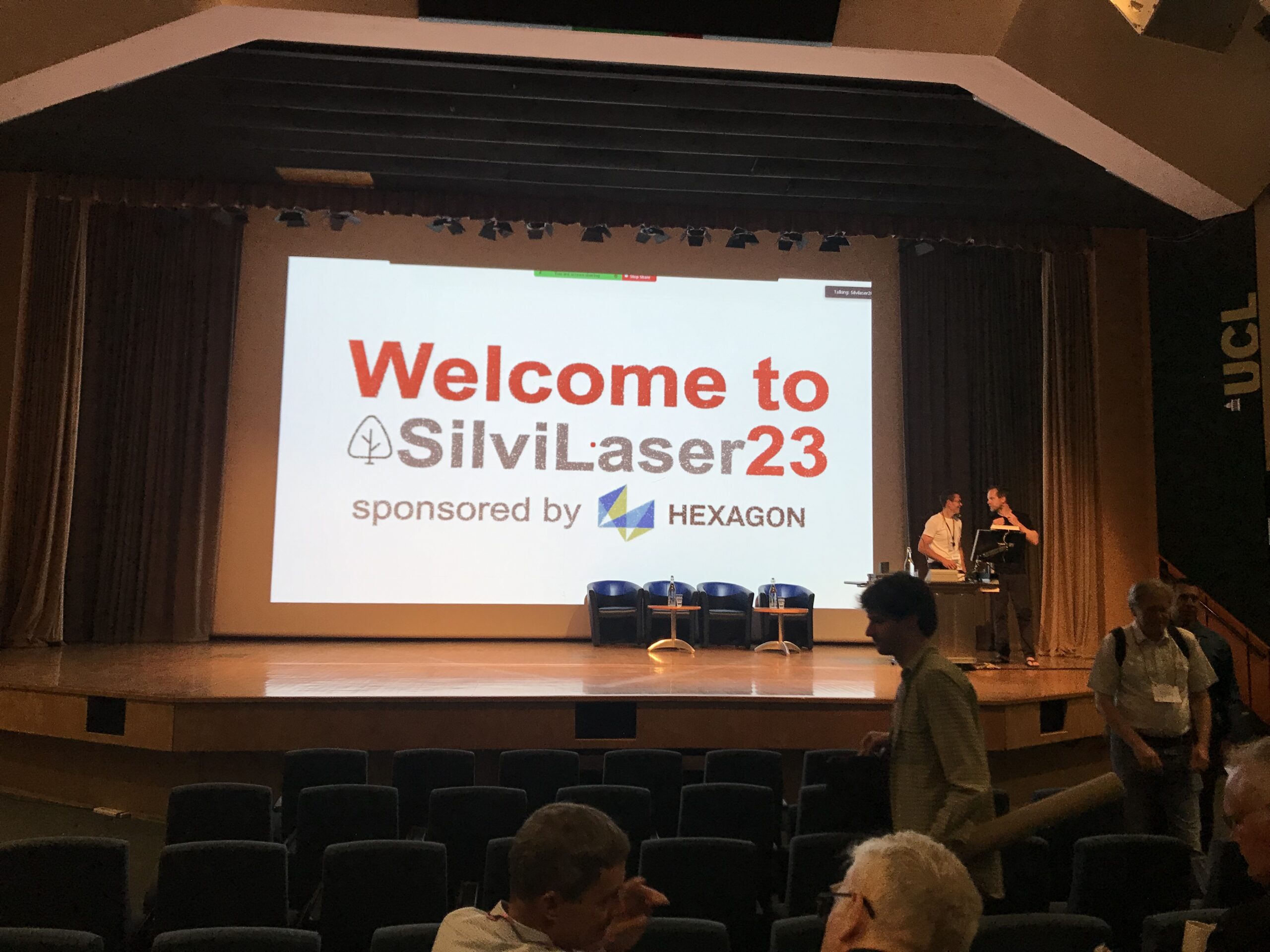
Impressions from Silvilaser 2023
Last week, our PhD student, Hannah Weiser, joined Silvilaser 2023 at University College London (UCL). The conference covers cutting-edge science and technology from the laser scanning and forest communities, which is a perfect match for Hannah’s PhD topic and 3DGeo research in general. The week started off with interesting workshops on Tuesday using some of…
-

Training on digitalization of participatory mapping in Kuala Lumpur
Featured Image: Training participants simulating a participatory mapping on the ground with the SketchMapTool. Last week, HeiGIT team member Anne Schauß held a workshop session in Kuala Lumpur, Malaysia, during a training of the International Federation of Red Cross and Red Crescent Societies (IFRC). The international training focused on community resilience and how to assess…
-
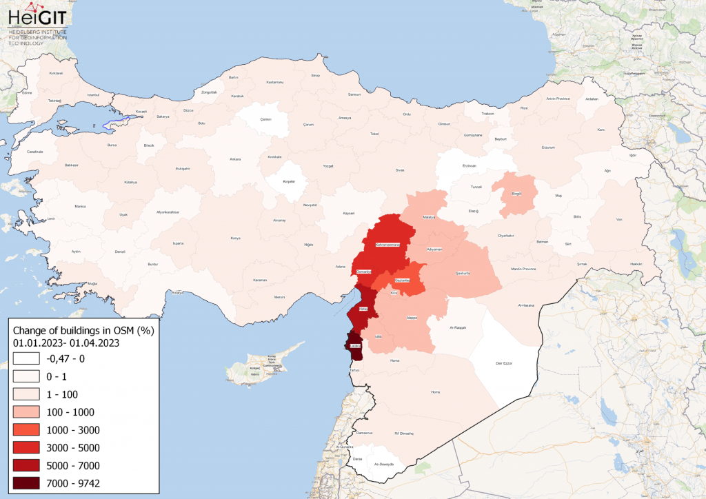
How to become ohsome part 15- Analysing Changes in OSM after the Earthquake in Syria and Türkiye in February 2023
Featured Map: Percent change in each province of Türkiye and Syria of buildings in OSM. Data from OpenStreetMap, visualized using QGIS and the ohsome API plugin. Welcome back to the how to become ohsome series! If you’re new to the series, you can check out the previous issues (like this one) or the ohsome Region of…
-
Introducing the VirtuaLearn3D Project
With VirtuaLearn3D (Virtual Laser Scanning for Machine Learning Algorithms in Geographic 3D Point Cloud Analysis), a new project of the 3DGeo group has started. The focus of this project is to enable powerful machine learning algorithms for geographic point cloud analysis by advancing the concept of virtual laser scanning to overcome the lack of training…
-
OSHDB Version 1.0 Has Arrived
Featured Photo: Ohsome dashboard interface for Heidelberg, Germany. In the words of Confucius, “The man who moves a mountain begins by carrying away small stones.” As we release OSHDB (OpenStreetMap History Database) Version 1.0, we look back at versions 0.5, 0.6, 0.7, and all the other small improvements to our historical OpenStreetMap database as the…
-
Time to celebrate! oshdb has reached an object count of >10 billion!
As of 02.11.2022 we have reached objects 10,107,826,483* in our oshdb. As such, we think it is most definitely time to celebrate! *For information on the background this figure, read our Basic guide to OSM data filtering 😉 This blog post is all about reaching 10 billion objects in OpenStreetMap. For the database to aggregate such…