
In January 2012 we launched OpenMapSurfer – a web map service with a set of custom layers that are based on geo-data of OpenStreetMap project. The main idea was to present OSM data in a different way by placing emphasis on the cartographic representation of data, namely to enhance the quality of the cartographic lettering on the maps using well-established cartographic precepts. It’s a well-known fact, that name positioning is an essential part of geographic map production.
“The expression “clothes make the man” applied to cartography would be “good form and placing of type make the good map.” Poor, sloppy, amateurish type placement is irresponsible; it spoils even the best image and impedes reading.”
Imhof, Eduard. 1975. “Positioning Names on Maps”,
The American Cartographer, Vol. 2, No. 2, pp. 128-144.
In spite of numerous and varied research efforts in the field of automated label placement, the problem is still vital and its solution is a compelling challenge. As we were interested in applying a label placement algorithm in web cartography (with the tile-based approach) then the solution of the problem becomes more difficult.
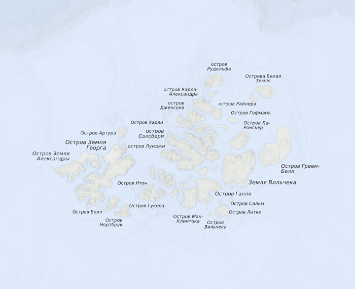
Firstly, we, the researchers at GIScience Research Group at Heidelberg University, have elaborated a comprehensive multi-criteria model for high cartographic quality label placement which can be used with any algorithm (for example: gradient descent, simulated annealing, genetic algorithm, etc.) to find an approximation of a global optimum of a label placement problem. Secondly, we applied a “hybrid” approach of label placement that can be used in tile-based maps, when a search space of a problem consists of a set of independent subdomains (tiles or metatiles).We have implemented the devised model on top of a toolkit for publishing spatial data to the web. And today we are happy to announce the release of our new map that was labeled using the developed model. The proposed model let us present geographical places in a clear and legible way even on lower zoom levels (see islands or bays).
New features and improvements on the map are:
-
Fully automated map labeling using new multi-criteria model.
-
Settlements in OSM database have been patched with the data from GeoNames project in order to meet a lack of data in OSM data that helps to use point-feature hierarchy more correctly.
- The label density for point-feature types is increased in average by 7 %.
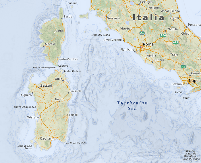
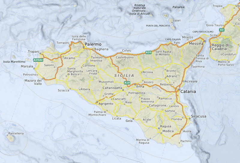
- Labels of islands, capes and water bodies (rivers, seas, gulf, etc.) were added on small scales.
- Color palette is heavily re-designed.
- Colored shaded ocean depth bathymetry .
- Depth contour lines (isobaths) of bathymetry.
- Hypsometrically colored and shaded relief using GlobCover and STM v4.1, ETOPO1 datasets.
- Names of marine polygons and maritime lines from NaturalEarthData map dataset.
You can see the results of our work right now on OpenMapSurfer. If you have suggestions about how to improve the current style of the map or you have mentioned a bug in styles or in the lettering, please feel free to contact us by e-mail or follow us on Twitter.
Currently, we applied enhanced labeling only to zoom levels z2-z12 since utilizing our multi-criteria model together with a rather sophisticated optimization algorithm is a time- and resource-consuming task. We are planning to make updates of this map for small scales (z2-z12) every month, the tiles on z13-z18 are updated automatically according to the commits of OSM users that are applied to our OSM database every hour.
Examples:
Leave a Reply
You must be logged in to post a comment.